Floriana to Hamrun
A surfeit of stations: The tunnel station
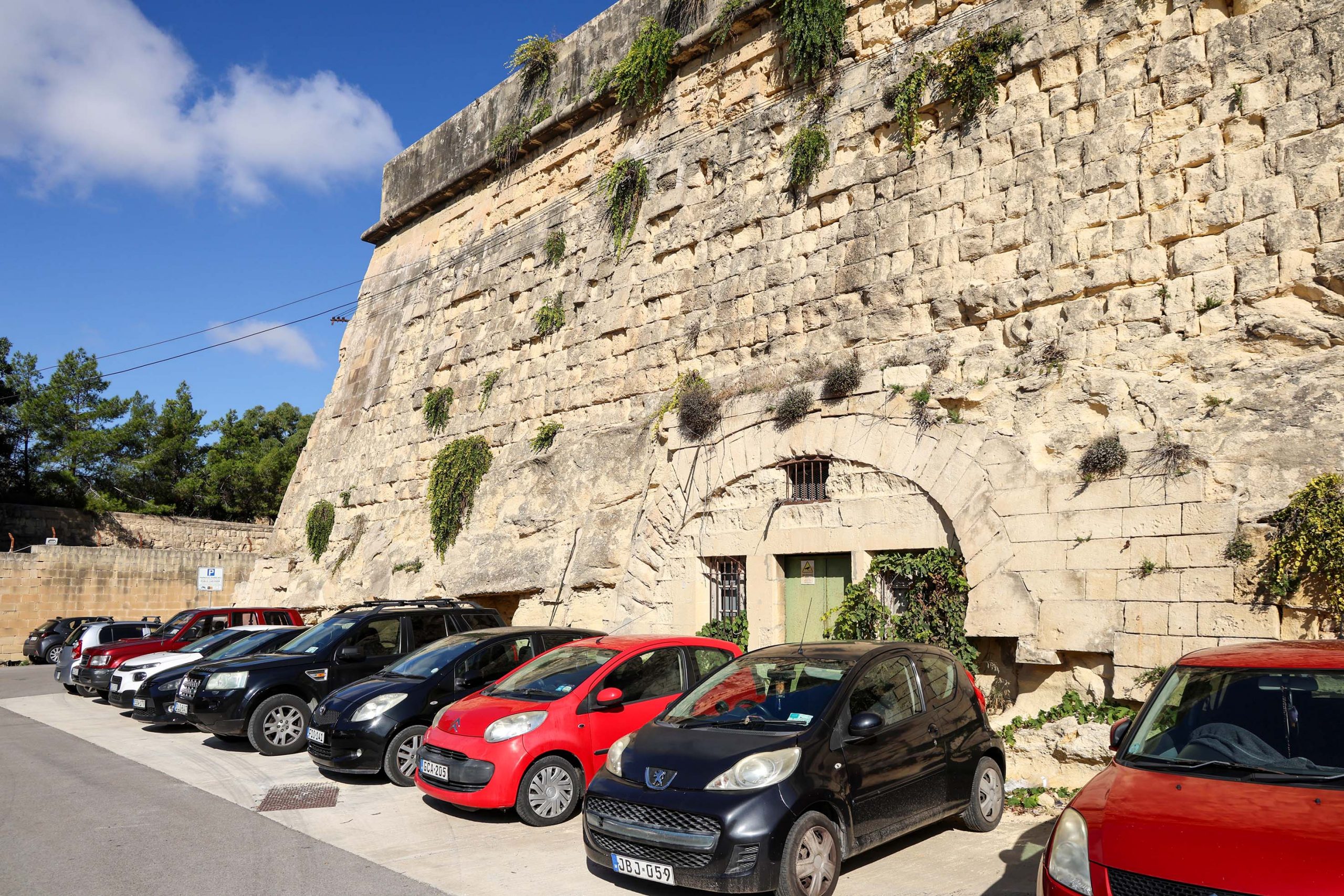
There’s a wealth of evidence for the railway in Floriana, though most is largely inaccessible outside of special events. Two station sites, one underground and one partially open to the sky, are located near the western end of the tunnel from Valletta.
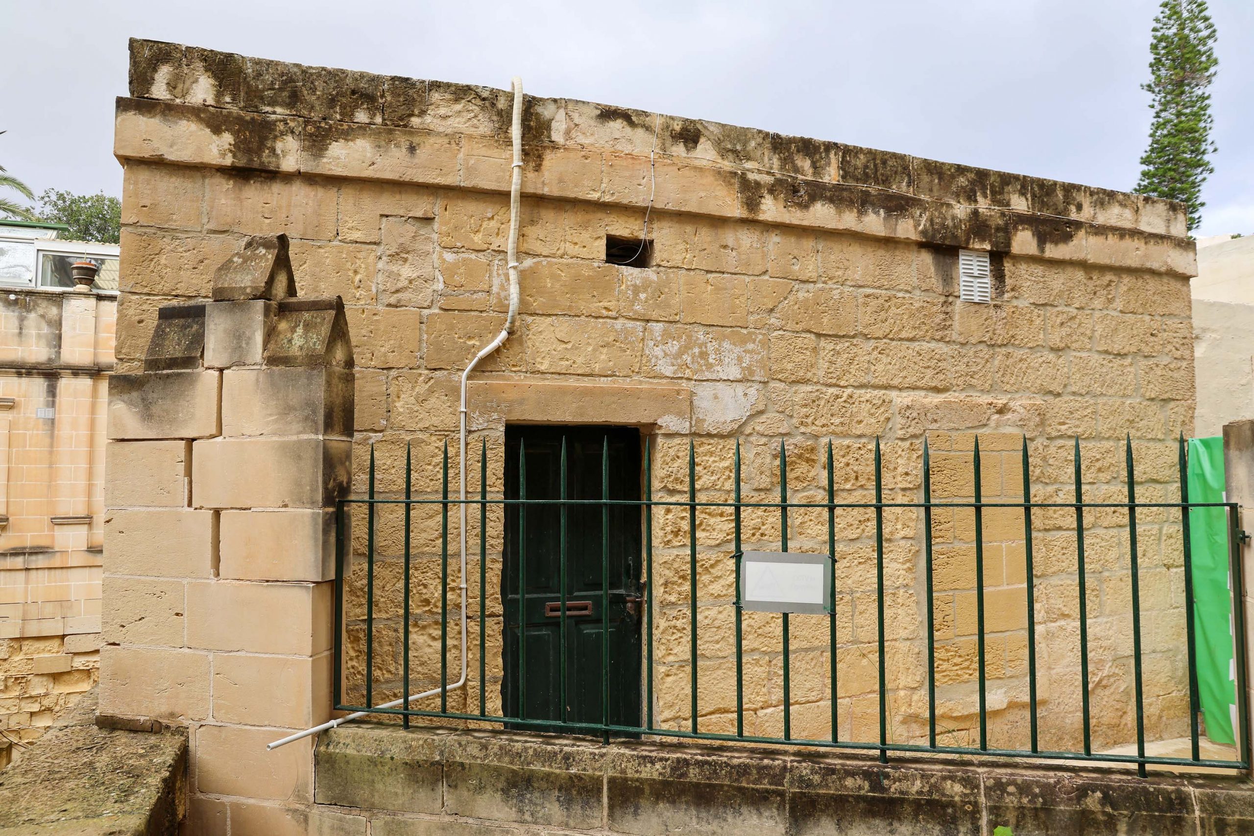
Beginning with the surface remains of these, the original 1882 plan was largely implemented with a ticket office and station entrance behind the Methodist church. The tiny building, enough only for a ticket office and entrance lobby for passengers, still survives. Now extended into a much longer building, the original structure is crammed into a corner at the far west end of the church.
The stonework has recently been cleaned and simple projecting door and window architraves and a cornice band are the only concessions to decoration. The slanting head to the stepped passage down to the platforms might be discernible as a scar in the paintwork in the building to the right.
Any visitor to the site will notice how inconvenient the booking office site is, and how anonymous and uninviting it is.
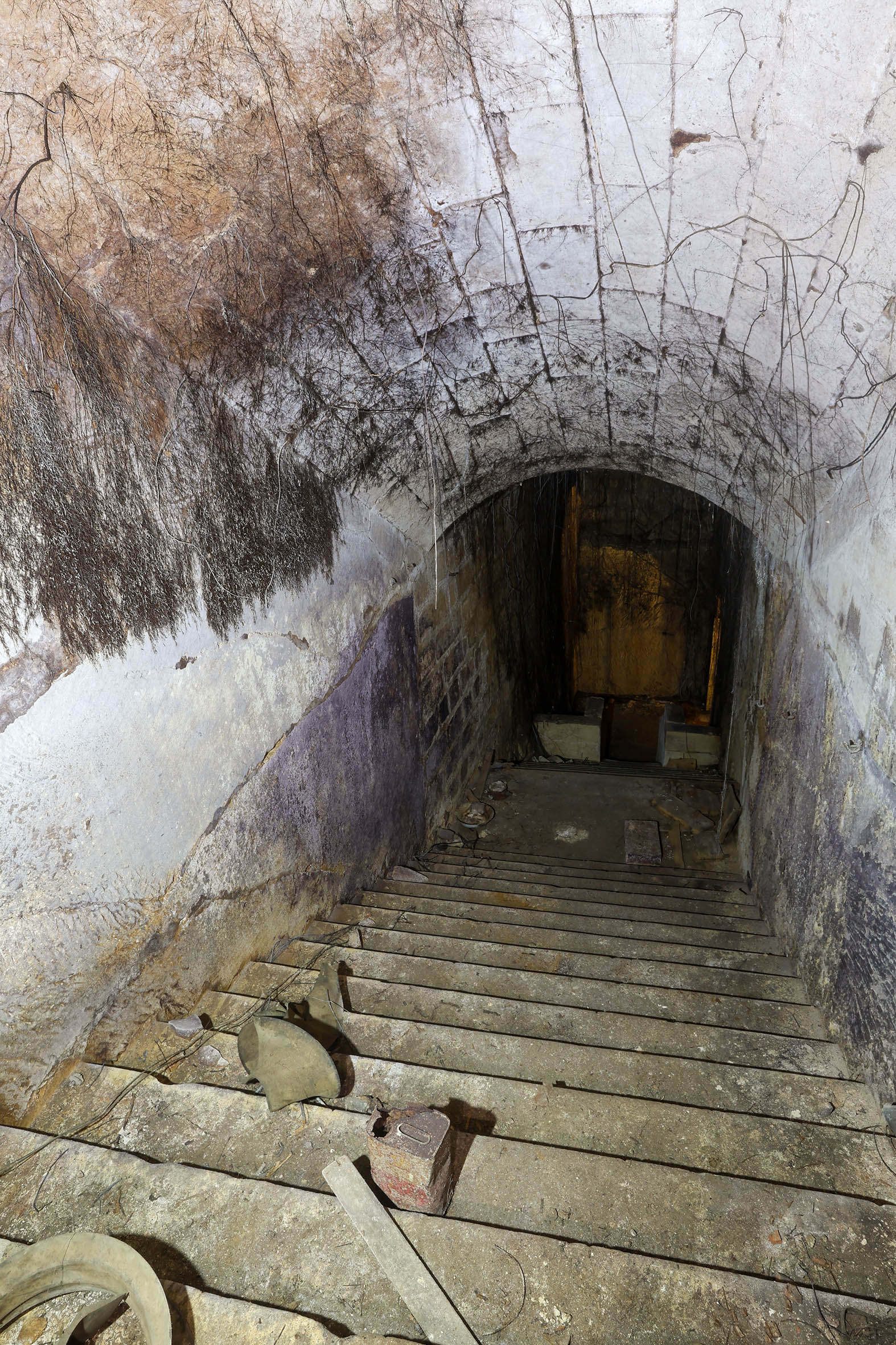
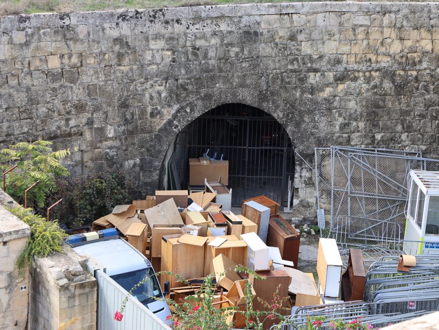
There’s no longer any access down through the building so today any explorer must enter from below; Concrete blocks form a wall at the head of the steps leading underground.
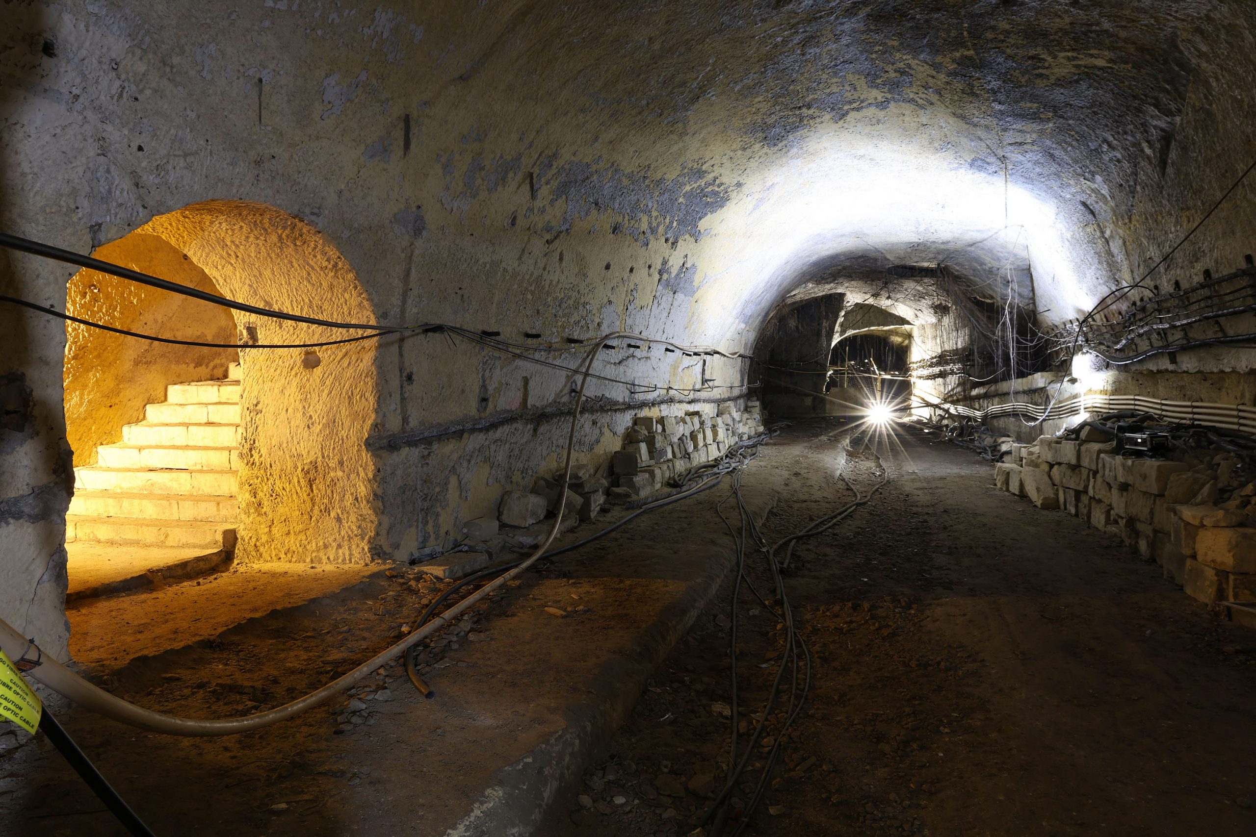
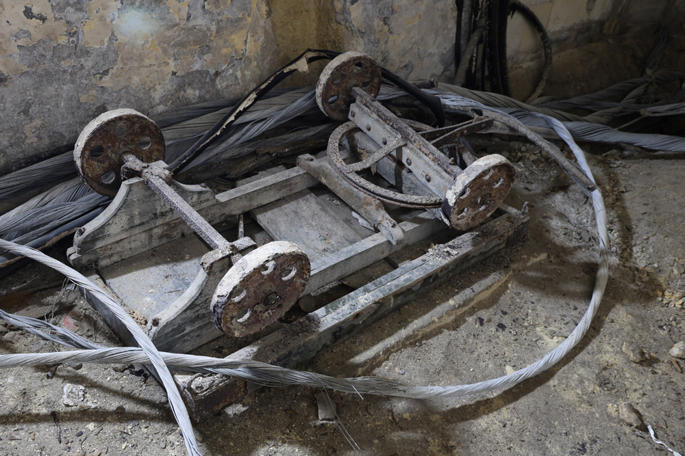
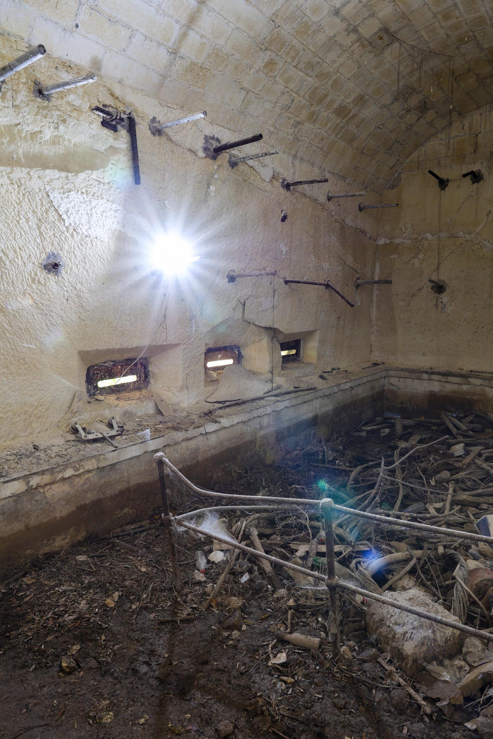
There are two flights of steps separated by a half-landing about halfway down their length. Interpretation of the Victorian station features is confused by later alteration of the station as bomb shelters in WWII.
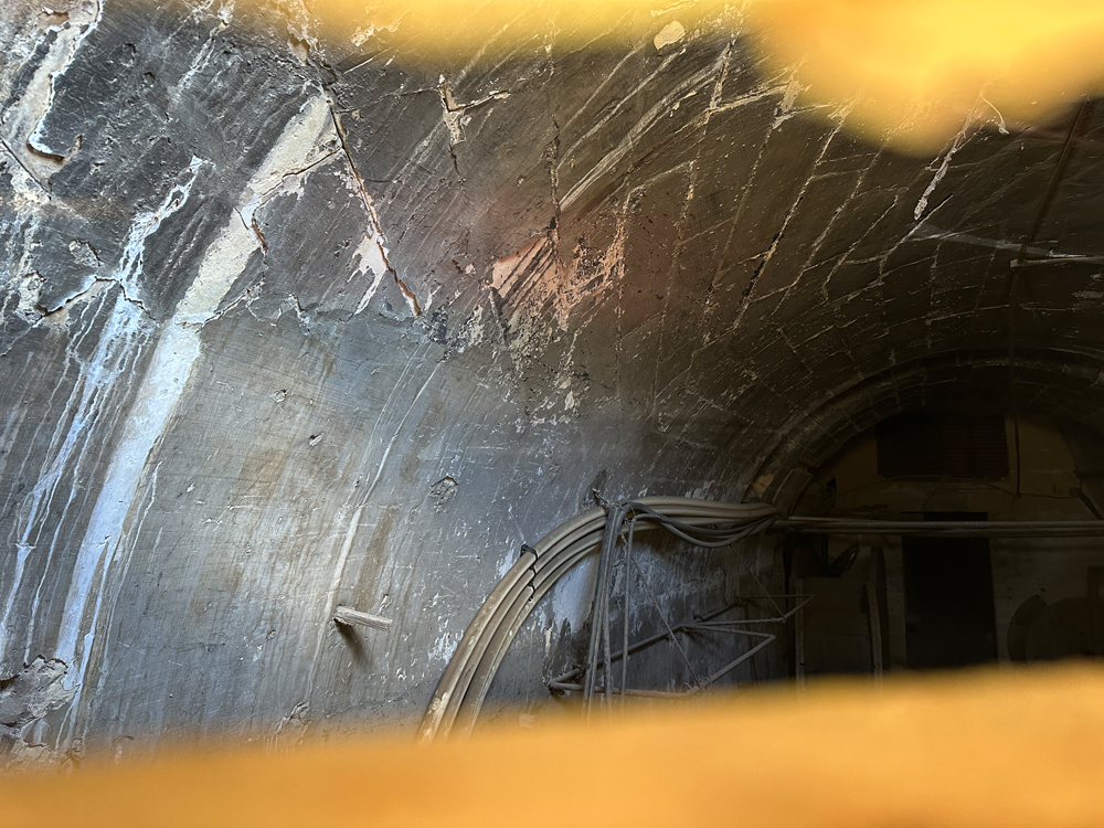
The first flight of steps has a vaulted roof formed of ashlar blocks, and a haphazard collection of steps down to the landing; Oddly, this is divided by an stone archway.
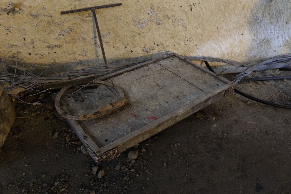
Half the landing on the other side of the door has been formed with steel rails and concrete, likely to be blocking the original light vent designed into this location.
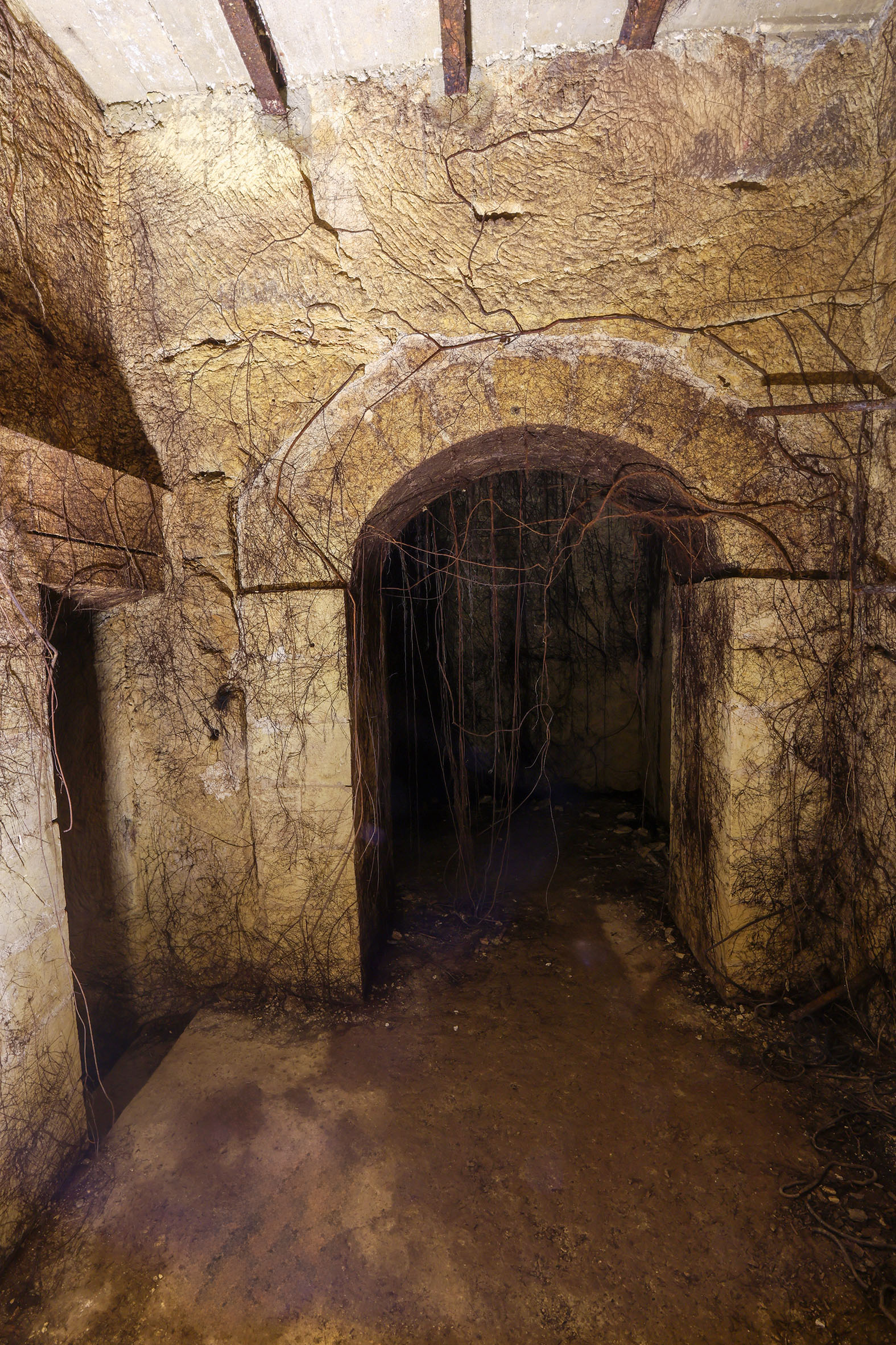
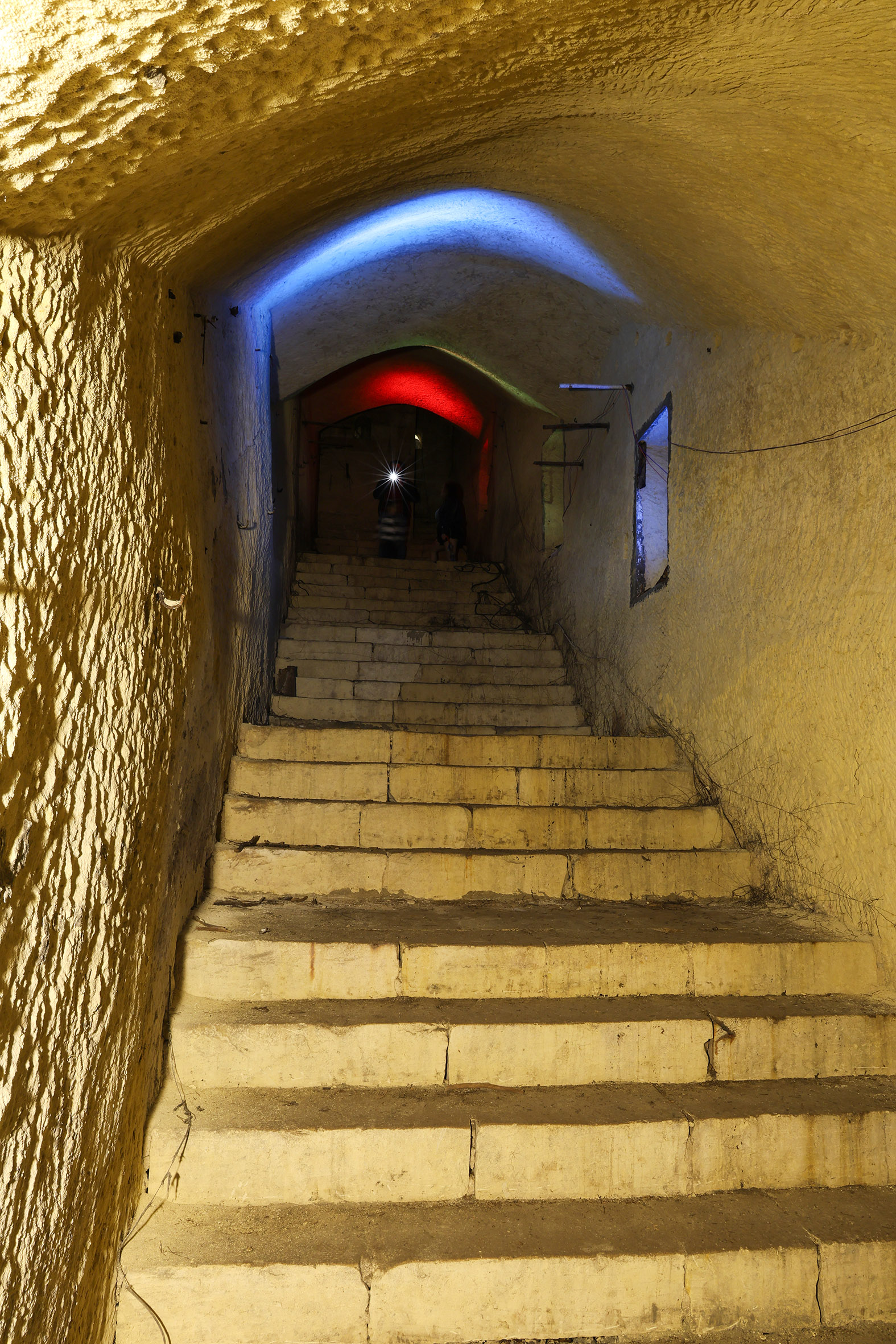
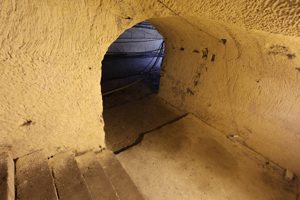
Post-railway passages and another blast wall separate the lower flight of steps from the landing. This section is roughly dug into the bedrock. The blockwork steps make their final approach to the platform turning left, through an archway at their foot.
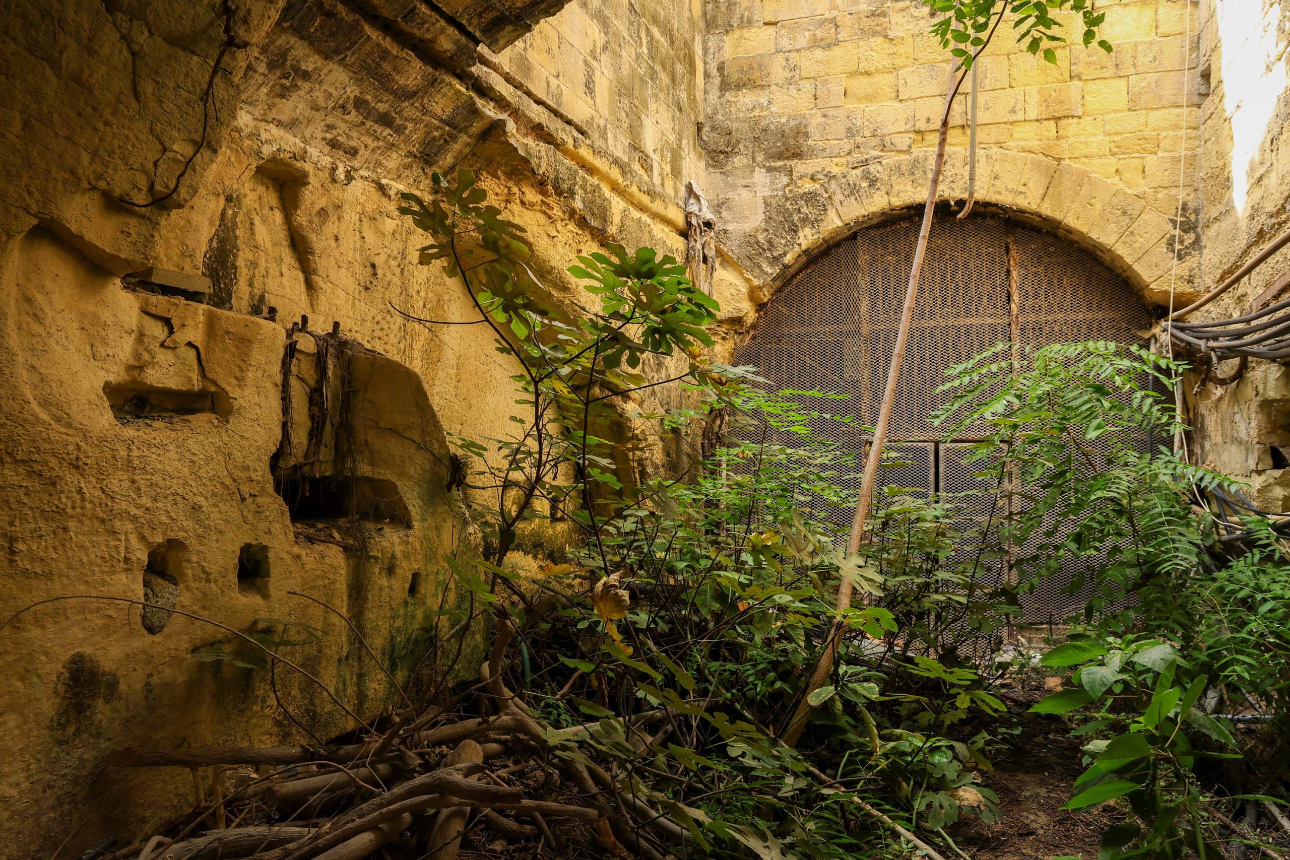
The station itself is defined by a widened section of the railway tunnel, the platform occupying its northern side. Whilst it feels spacious today, with a smoking locomotive and train pulling-in and only a 10ft deep platform it must have felt claustrophobic and mildly terrifying.
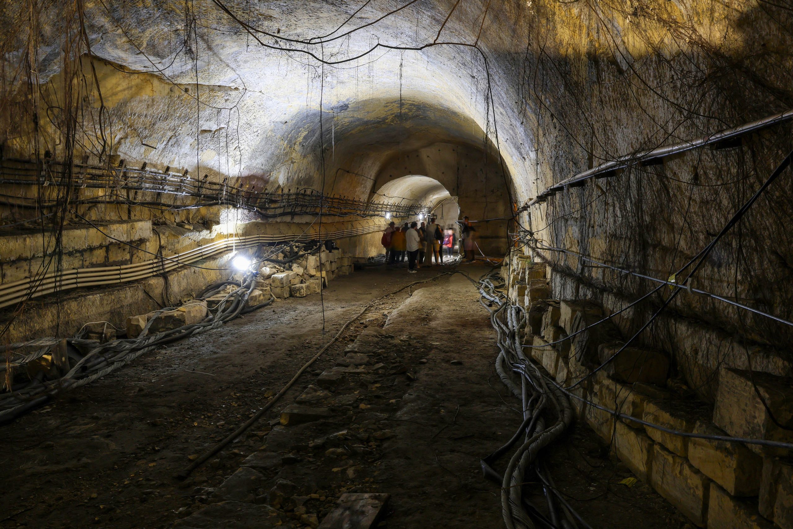
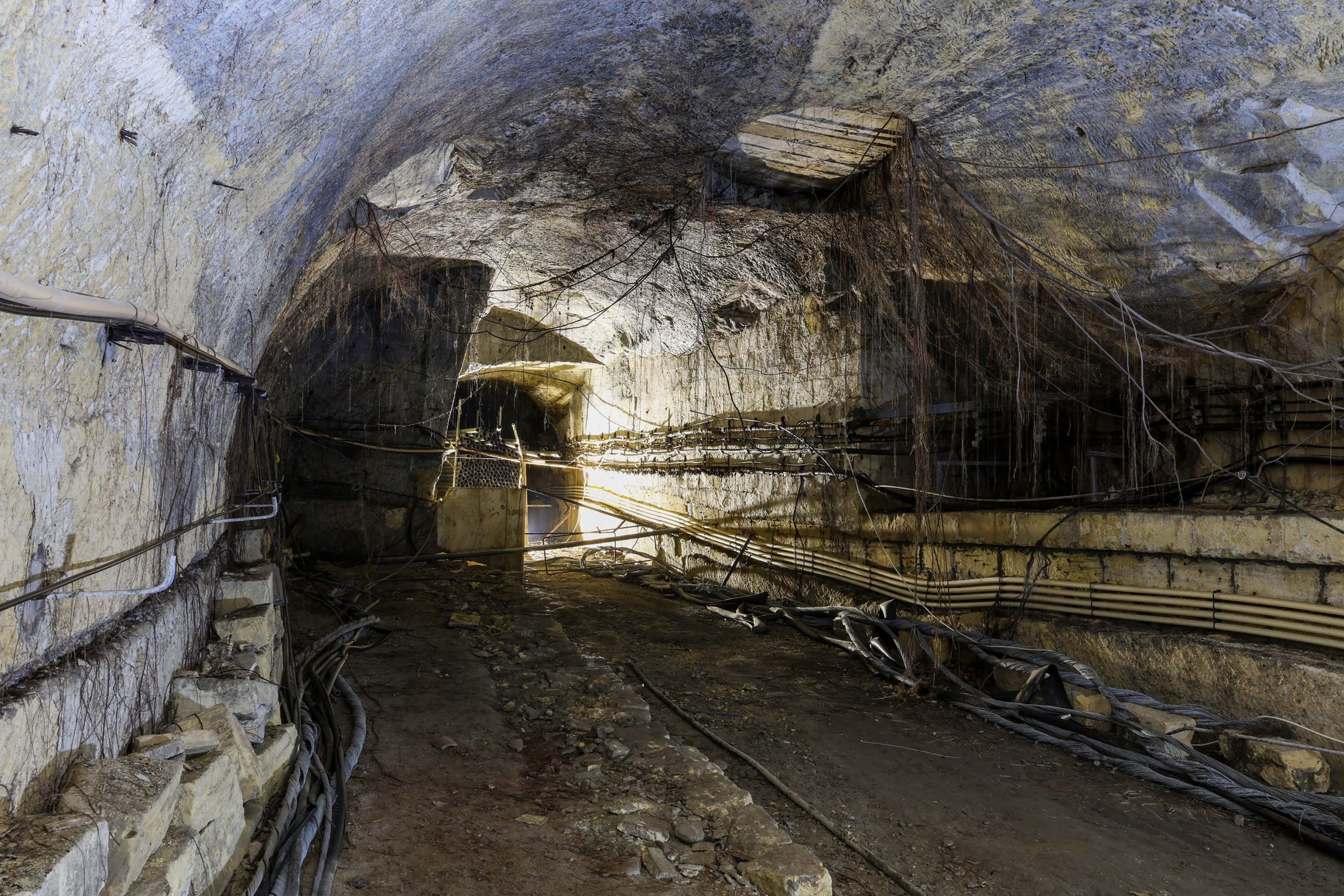
The platform edge remains well defined, stretching back up the tunnel in the direction of Valletta for 120feet. At the far end an oval vent in the crown of the vault was the only ventilation for the whole station.
It’s unclear what the mined-out sections are on the south side of the station tunnel. It’s likely that this was a fault in the geology that needed removal to make it safe, and a block-built section of tunnel wall supports this theory and the vault itself!
The tunnel continues westward towards the site of the new station, but we’ll return to the surface to explore its approaches.
A surfeit of stations: The second station
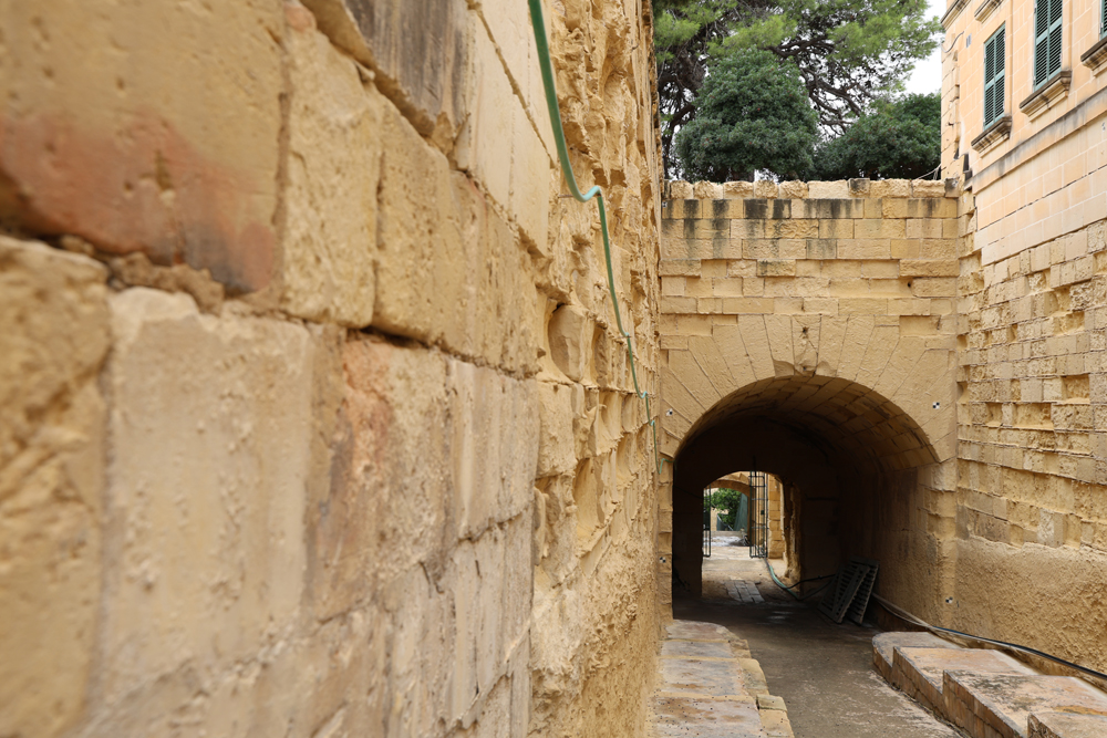
The new facility made use of existing ramps cut through the city’s fortifications by the Knights.
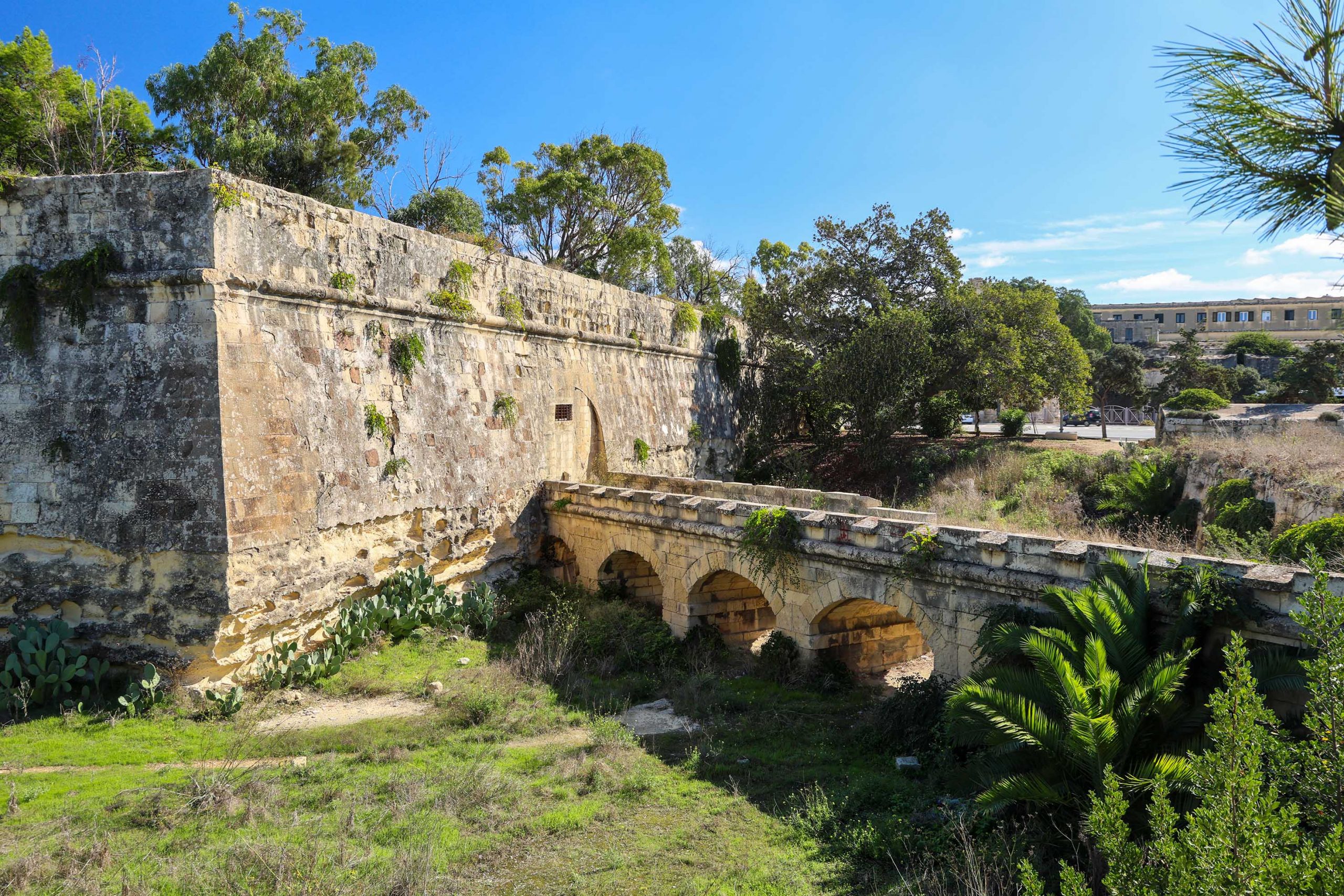
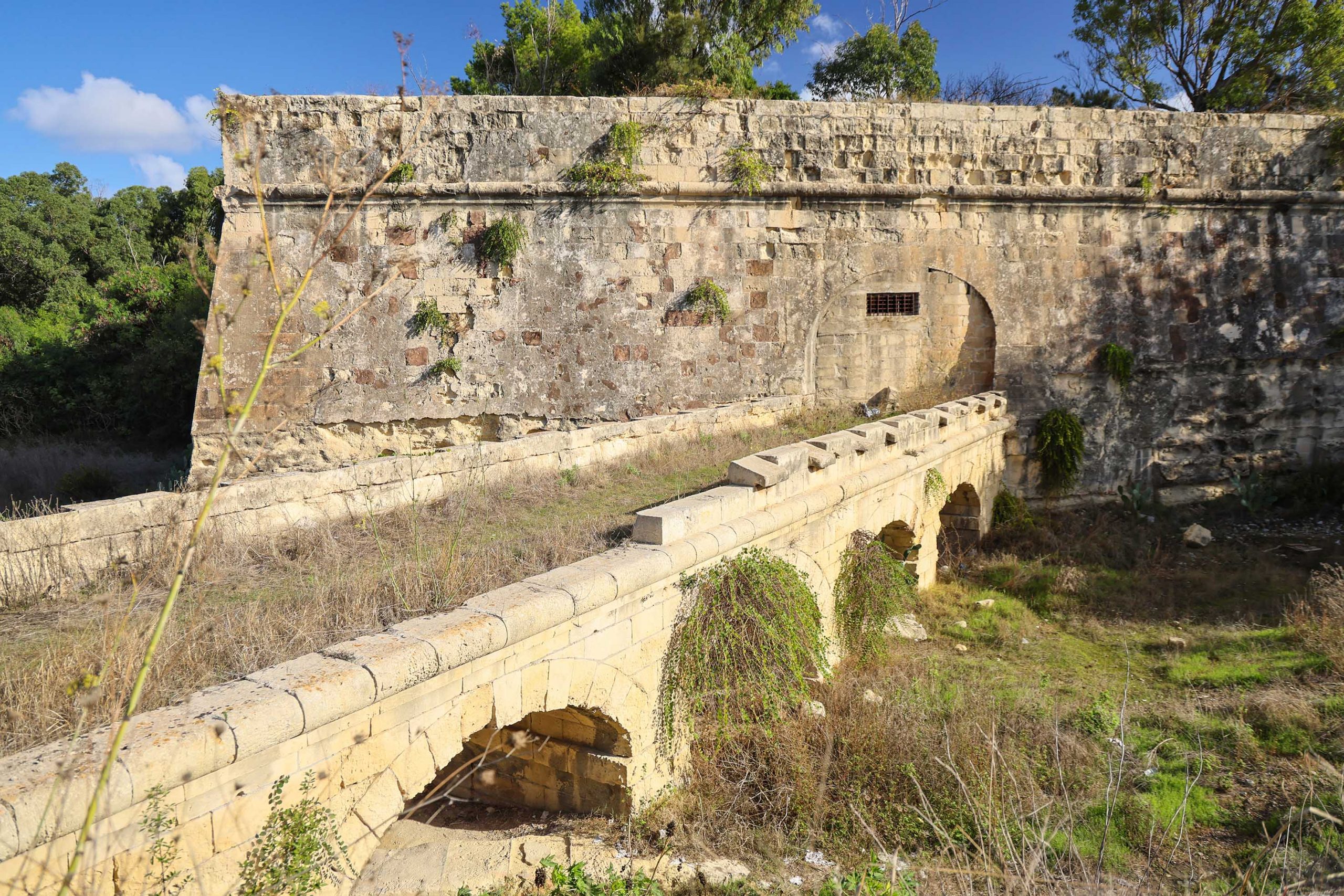
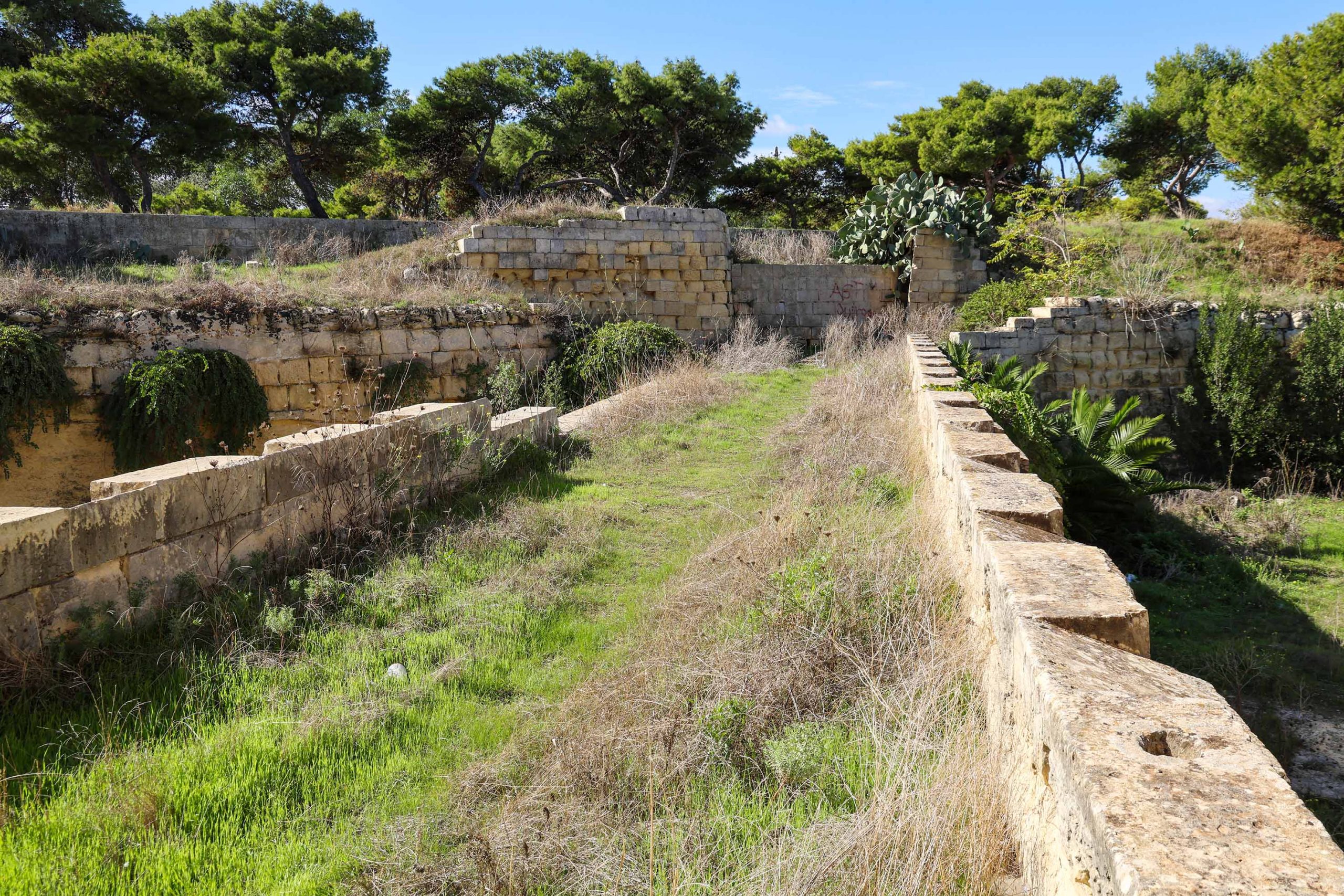
A long ramp along the edge of Argotti Gardens passes directly behind the original station building and on towards St Philip’s Bastion. Off this a new junction was made into a large trench cut down to track level.
A new ramp descends off the earlier alignment at right-angles, immediately crossing over the railway by means of a steeply angled bridge. The original decorative iron railings and hand rail survive here, but the ramp is clogged with vegetation and not entirely safe for modern use.
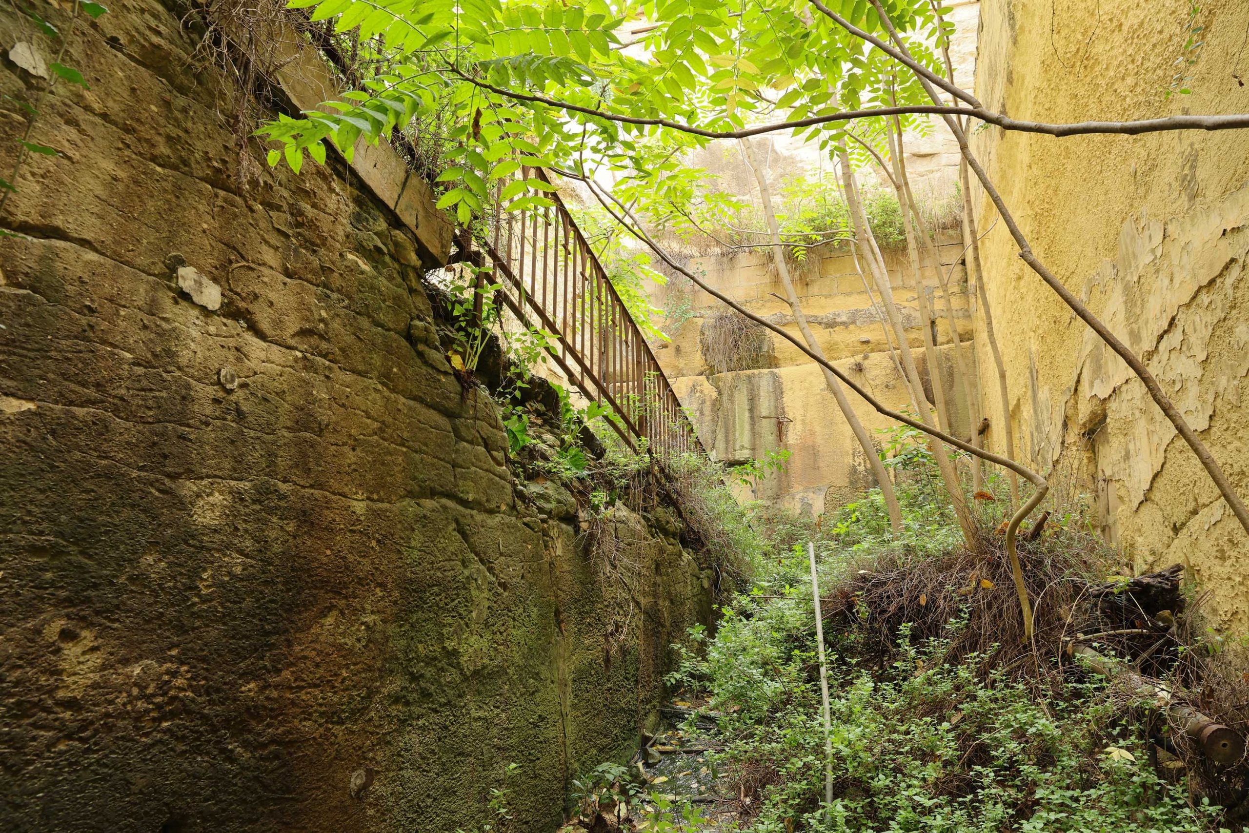
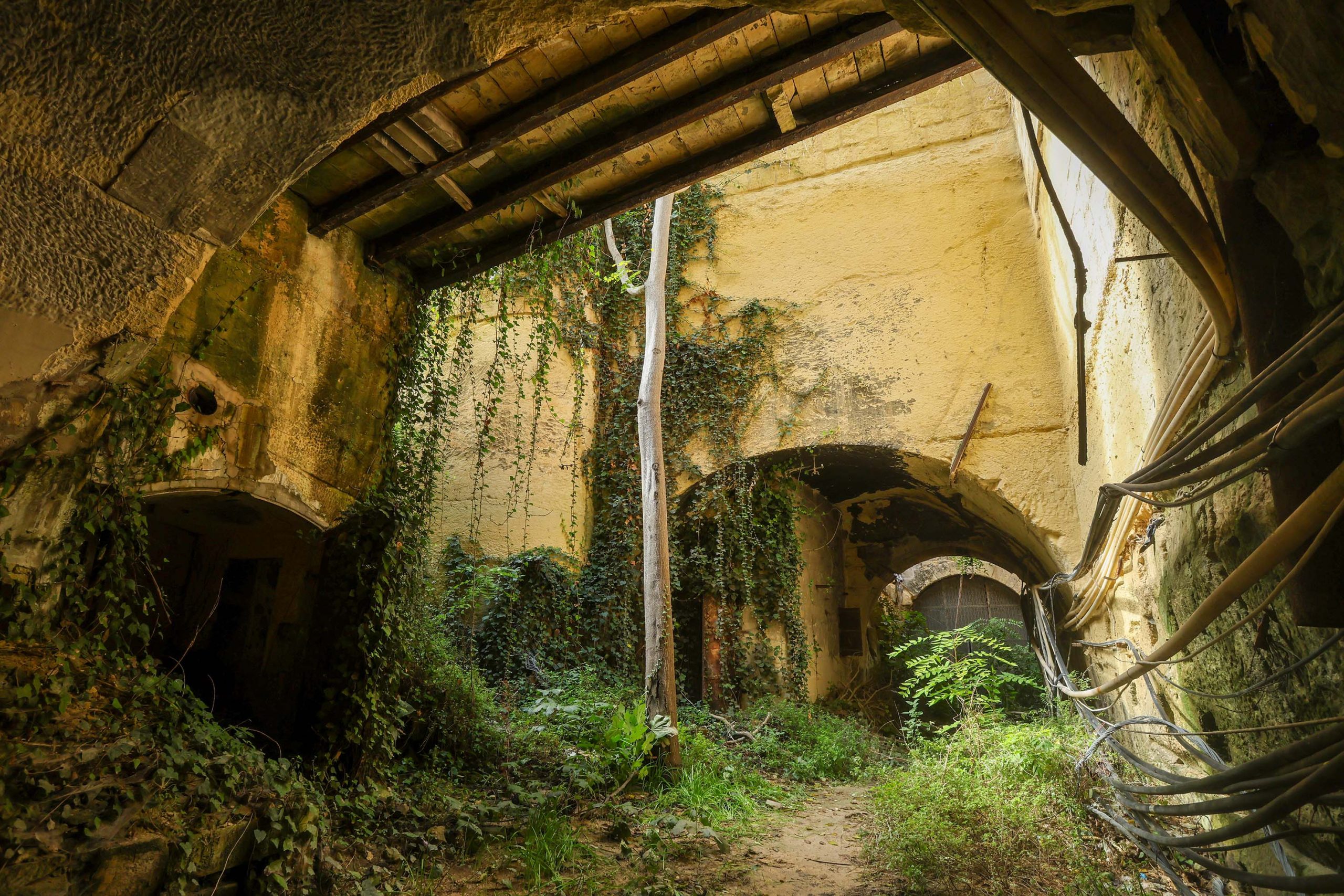
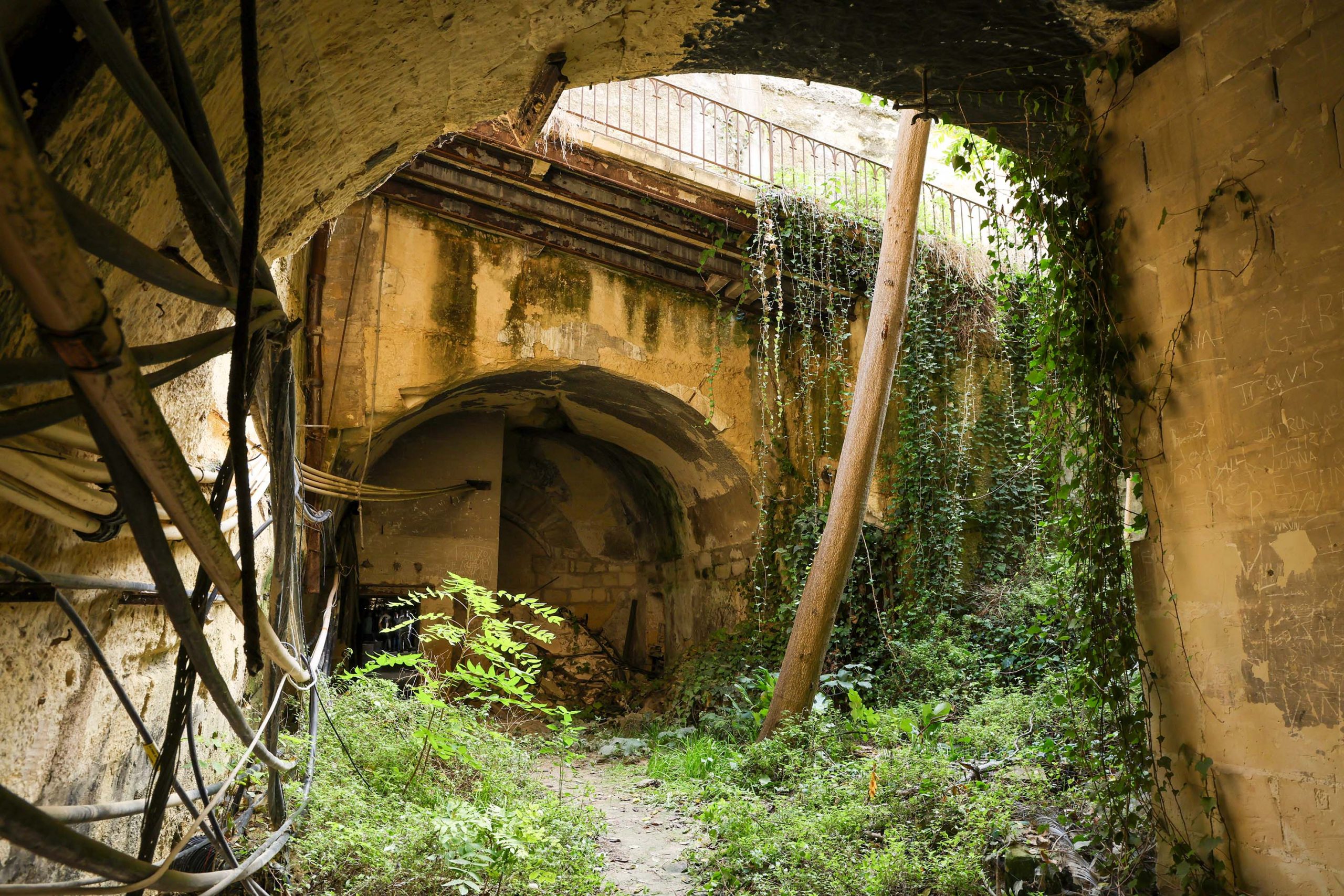
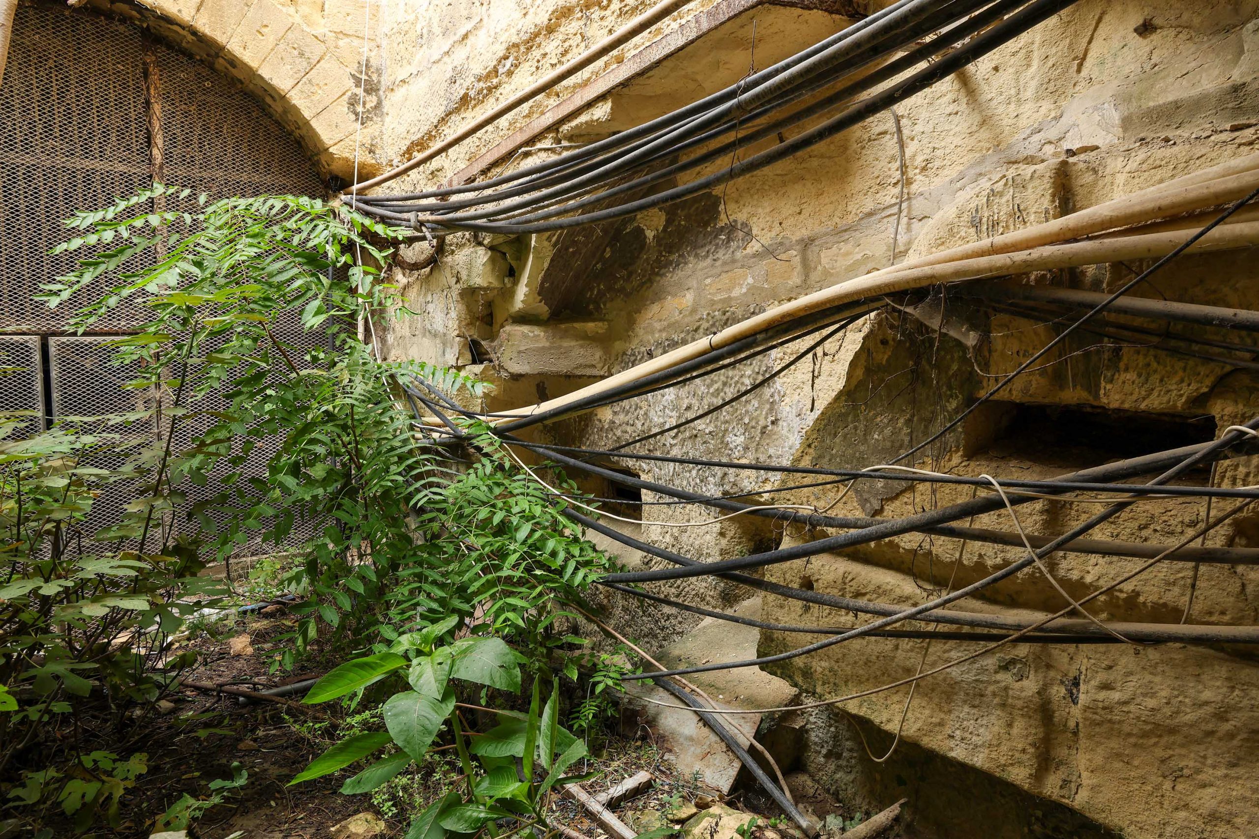
The ramp meets a landing before turning and completing its descent to platform level. An ornate lamp bracket guards the platform threshold from its mount on the bottom corner of the ramp. Here, another widening of the tunnel has been made, making space for a platform on the south side of the track that’s now obscured. Although located deep below ground level the space is light and feels generous despite some post-railway era structures infilling parts.
Some scars and compartments cut into the rock date to the railway era, including what is likely to have been a ticket office directly beneath the ramp.
Another reminder of the railway is the smoke-blackened vault. Engines approaching Floriana were forced to make a steep ascent through the tunnel requiring a good head of steam and no doubt a well-stoked firebox.
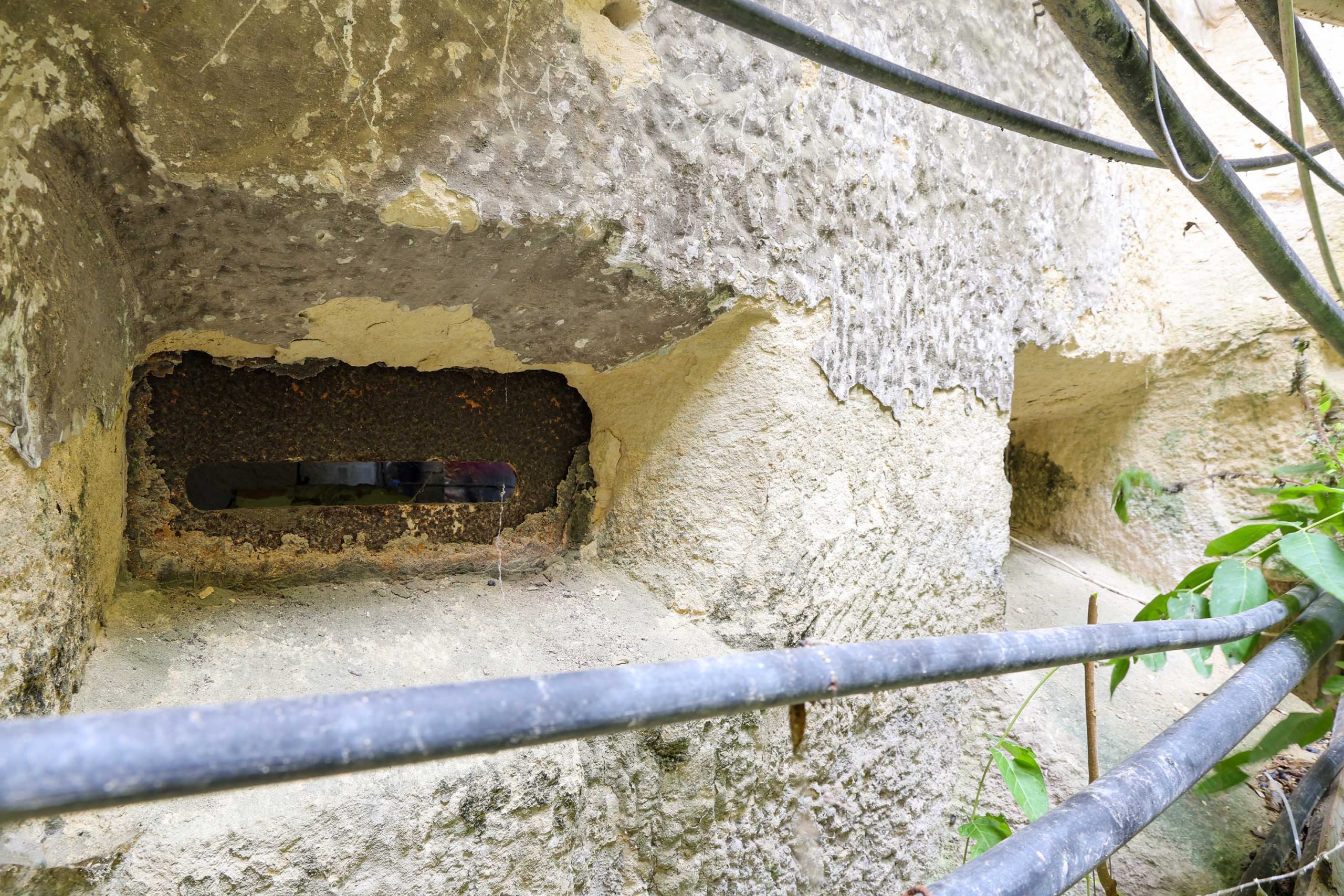
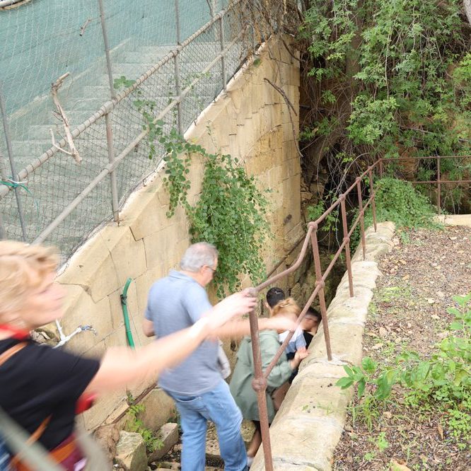
To the west of the station site, and forming the present access to it on open days, the surviving military guardhouse is perhaps unique; It’s gun ports still look onto the trackbed.
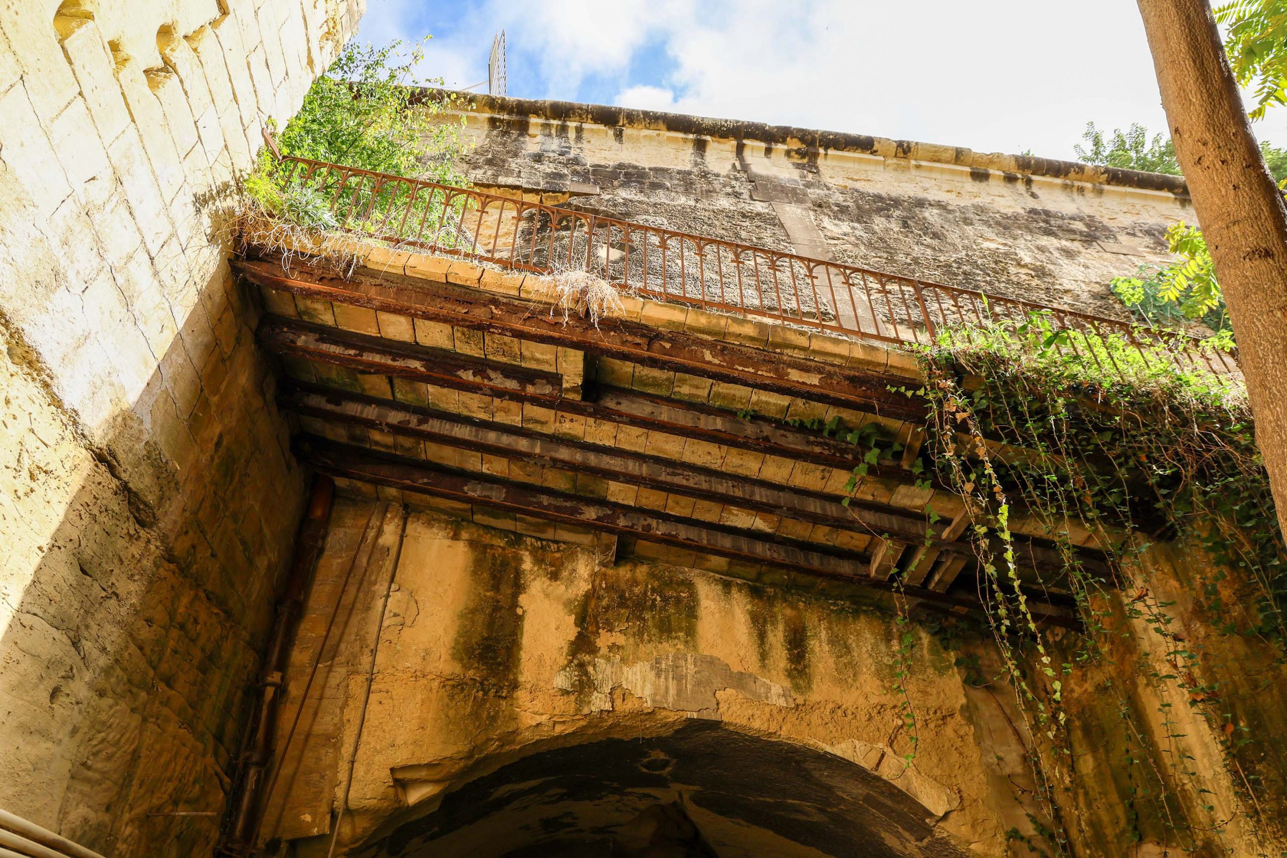
Visitors should take note of matching cuts into the tunnel sides at this point. The distinctly curved features are designed to accommodate a raising bridge at this point, designed another defensive measure.
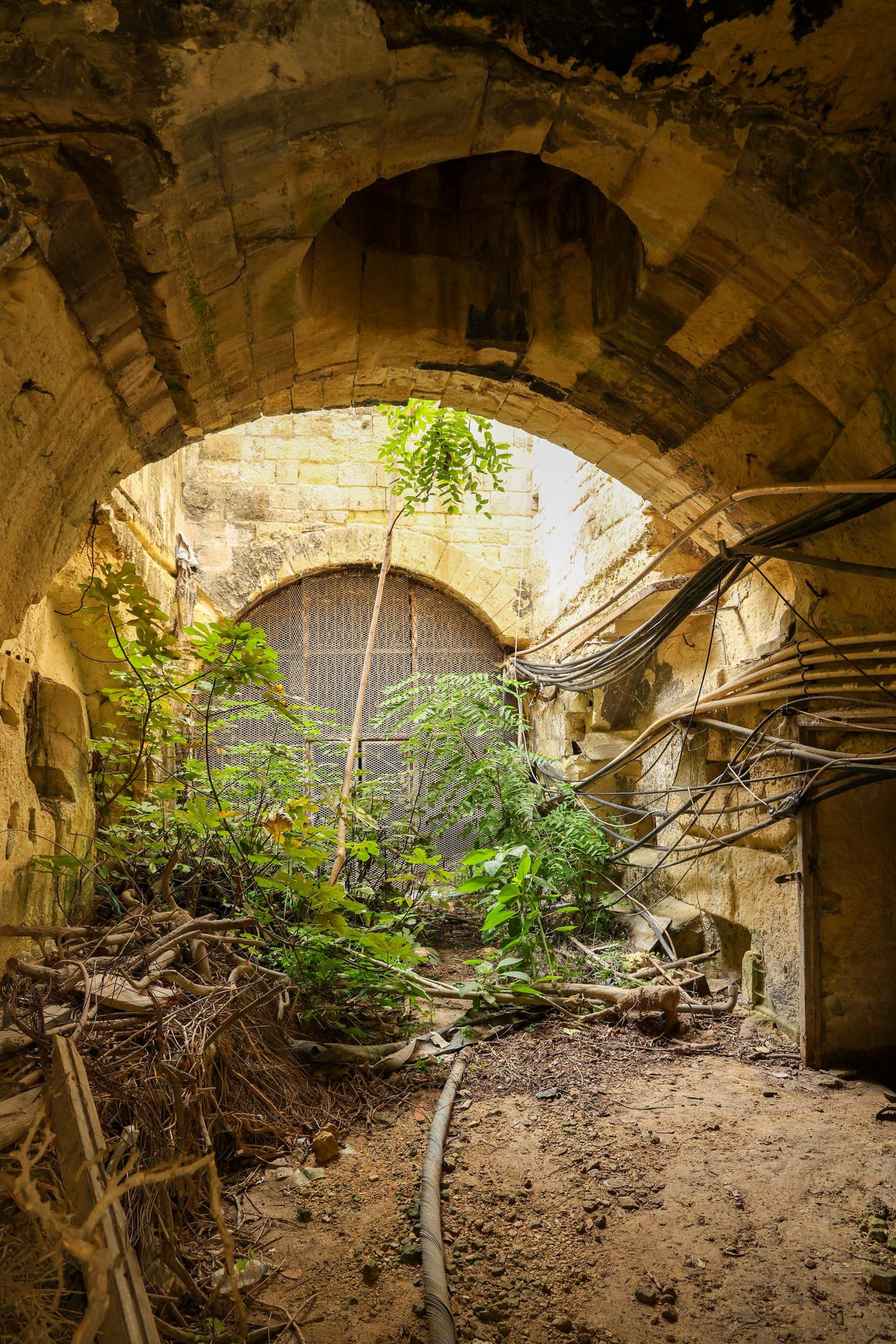
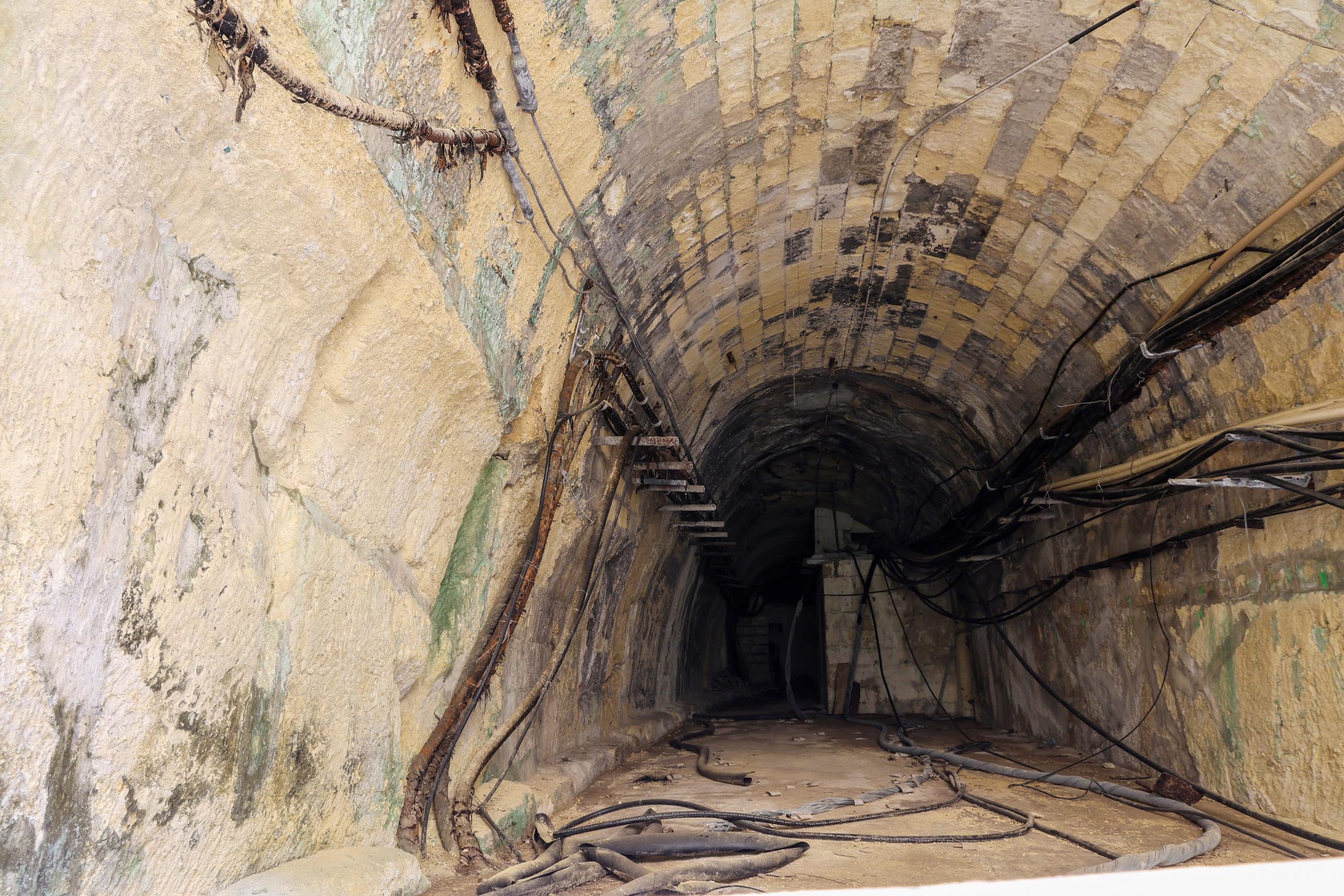
The tunnel roof over the lift bridge site is open to the sky. This was originally intended to have a stone vault, but, as noted on the original drawings, the rock was found to be too unstable. The natural daylight helps illuminate the former station site and the defensive works.
The tunnel continues west beneath St Philip’s Bastion, but the way is barred by a gate. Through it can be glimpsed the tunnel’s southern wall hollowed out for some distance, a feature added to accommodate the narrowest of platforms stretching back from the station site. Above ground the line of the tunnel can be followed across the bastion by a series of ventilation chimneys erected over the original shafts.
There’s a possibility that further defensive works were incorporated in this section of the tunnel, but until we’ve been able to visit, we’ll not jump to any conclusions.
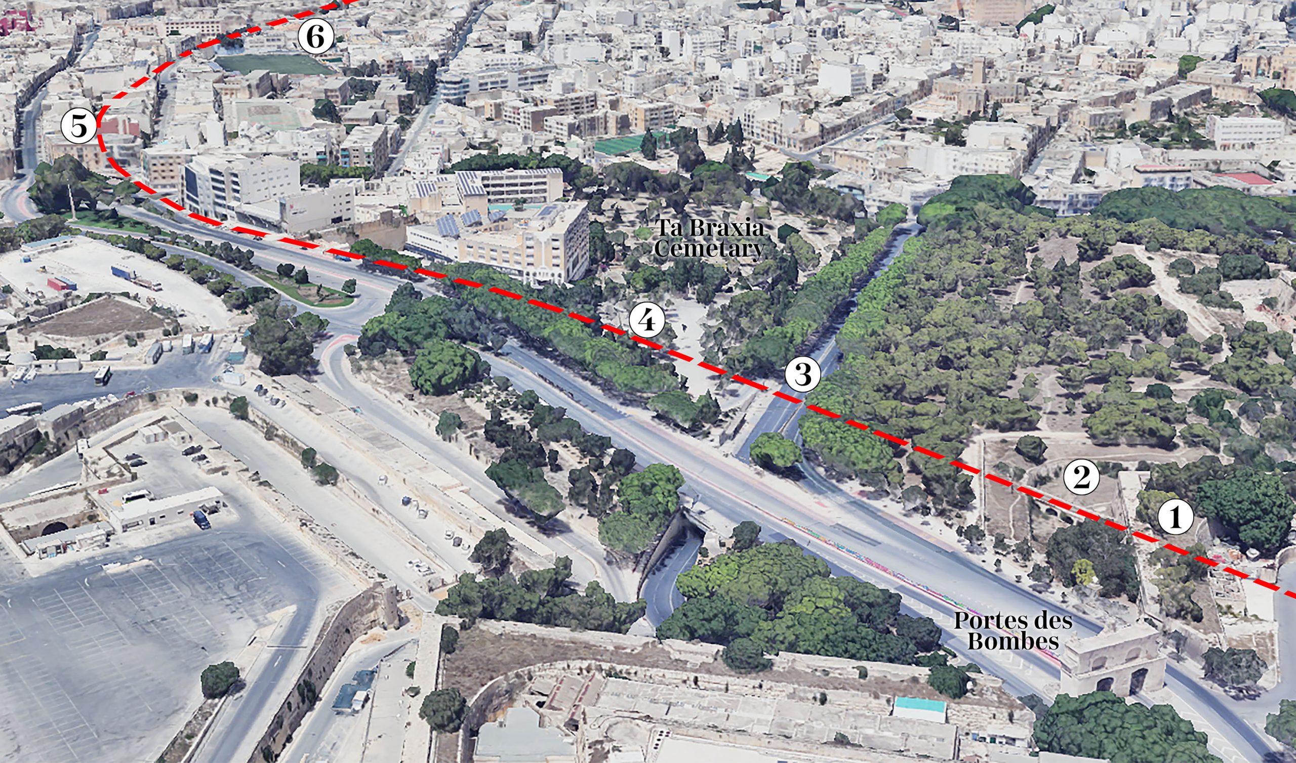
Beyond the Walls
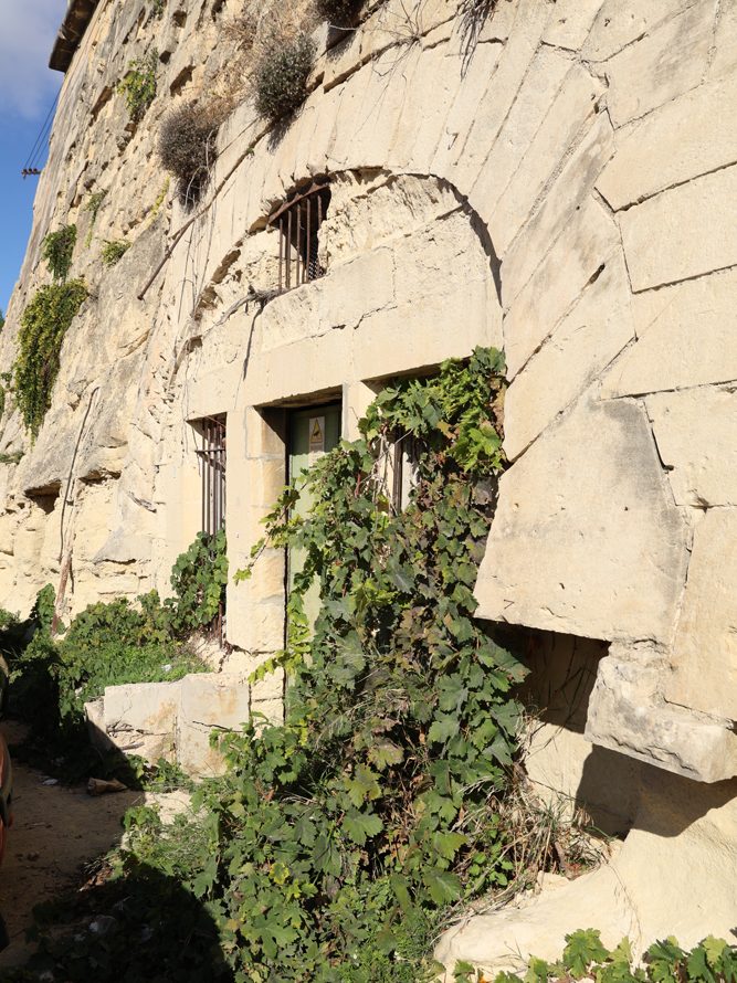
Until recently there was more to see at the tunnel portal where the railway existed into Notre Dames ditch. Until tarmacked-over the foundations of the railway guard hut, platform, and parapets of the short bridge that once crossed the drop ditch here, were all visible.
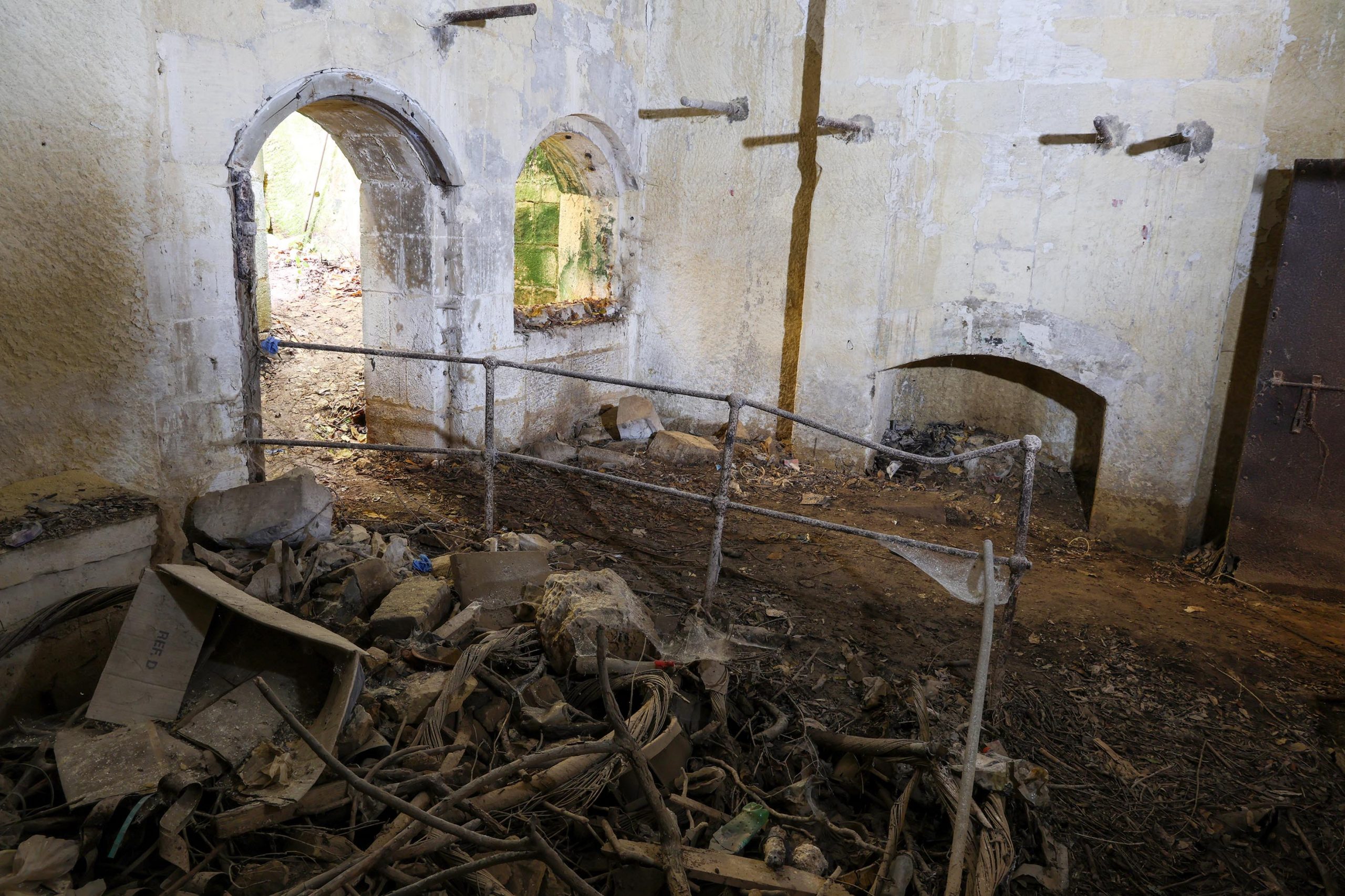
The tunnel opening has been infilled with a wall during conversion of this section as a telephone exchange, but its shape betrays its historic function. The radiating voussoirs add distinction to the arched form.
The track alignment passes anonymously through a car park and behind a modern wall. The final tunnel through Floriana’s fortification survives as a gated opening hidden from view at ground level but can be seen by looking down from St Philip’s bastion.
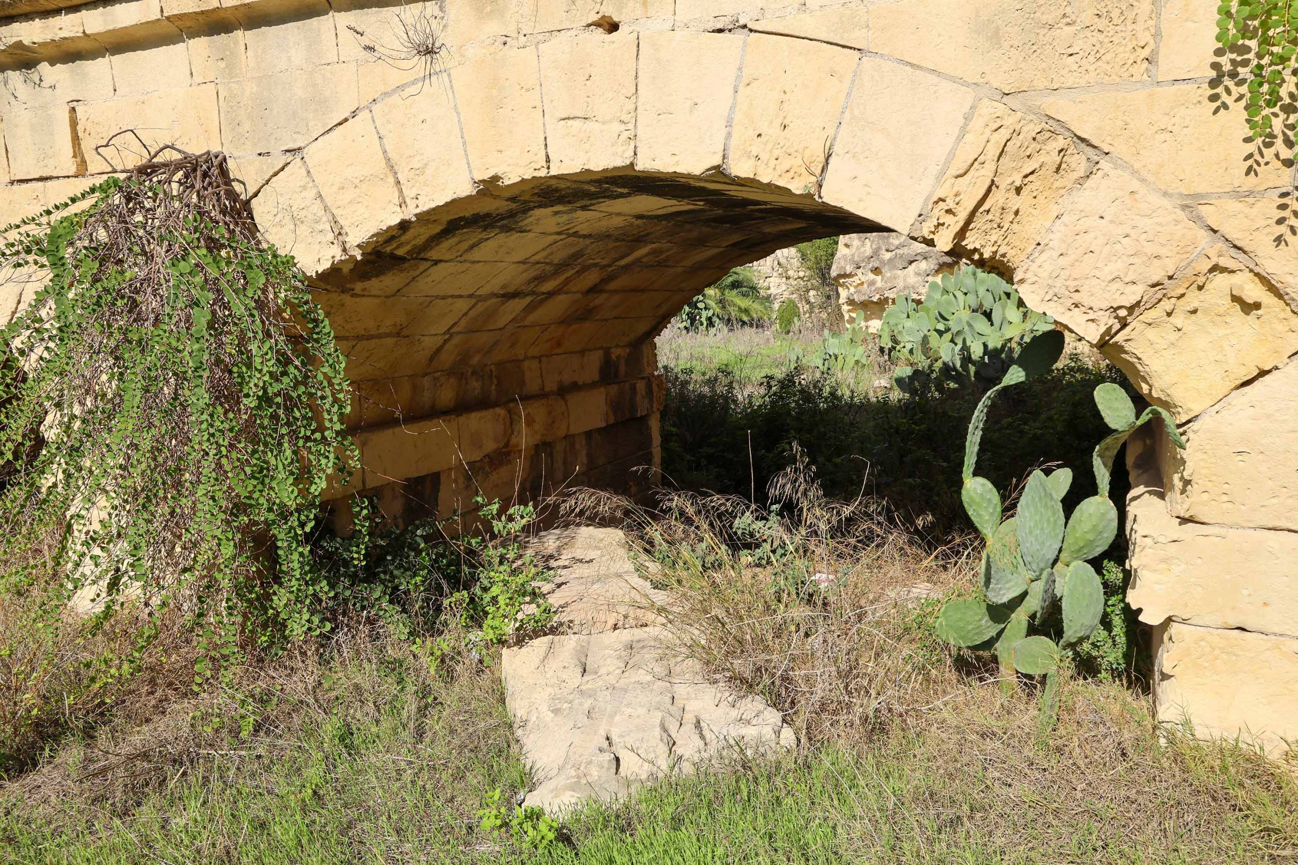
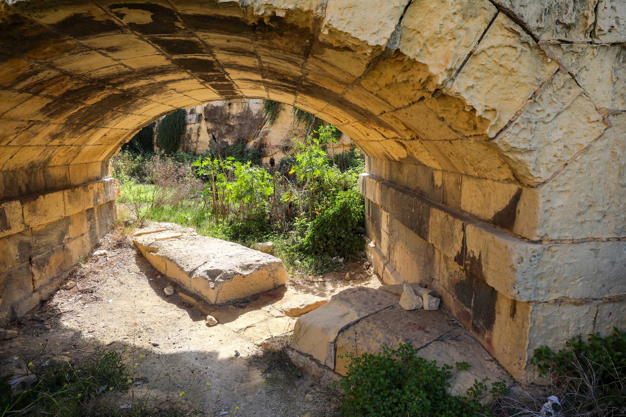
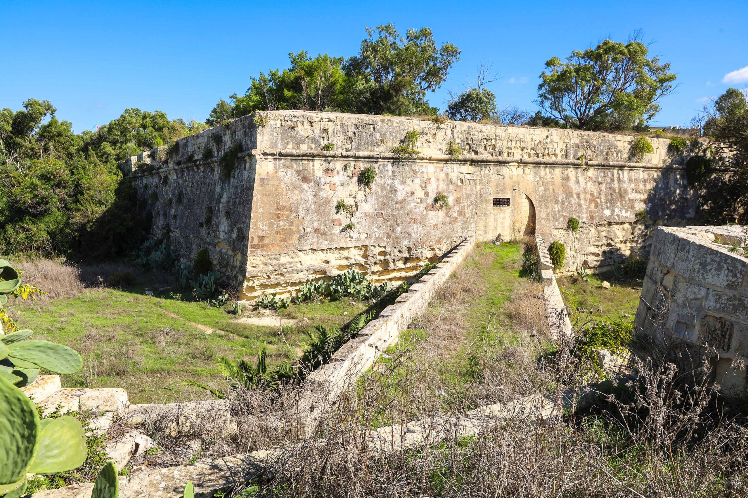
The viaduct close to Porte de Bombes is one of the most memorable locations on the line. The railway exists Fosse Bray tunnel before immediately vaulting the city ditch by means of a low bridge with ornamental battlemented parapets. The thrust of the fortifications, direct alignment of the trackbed, and the skewed bridge add a dynamic dimension to the picture.
Access onto and beneath the viaduct is public, giving the railway scholar unequalled opportunity to explore the site. Descending into the ditch the visitor will find long, large, angled stonework in the ground beneath the bridge arches. These are the copings of the surviving piers of the original timber bridge, replaced when the line entered Government hands after the structure became dangerously decayed. Shallow rebates into the coping stones indicate where timberwork was erected.
The west end of the bridge once approached a low cutting through a final military ravelin, but this has been infilled. You can still see two short sets of stone steps descending to track level allowing the public to cross at this point.
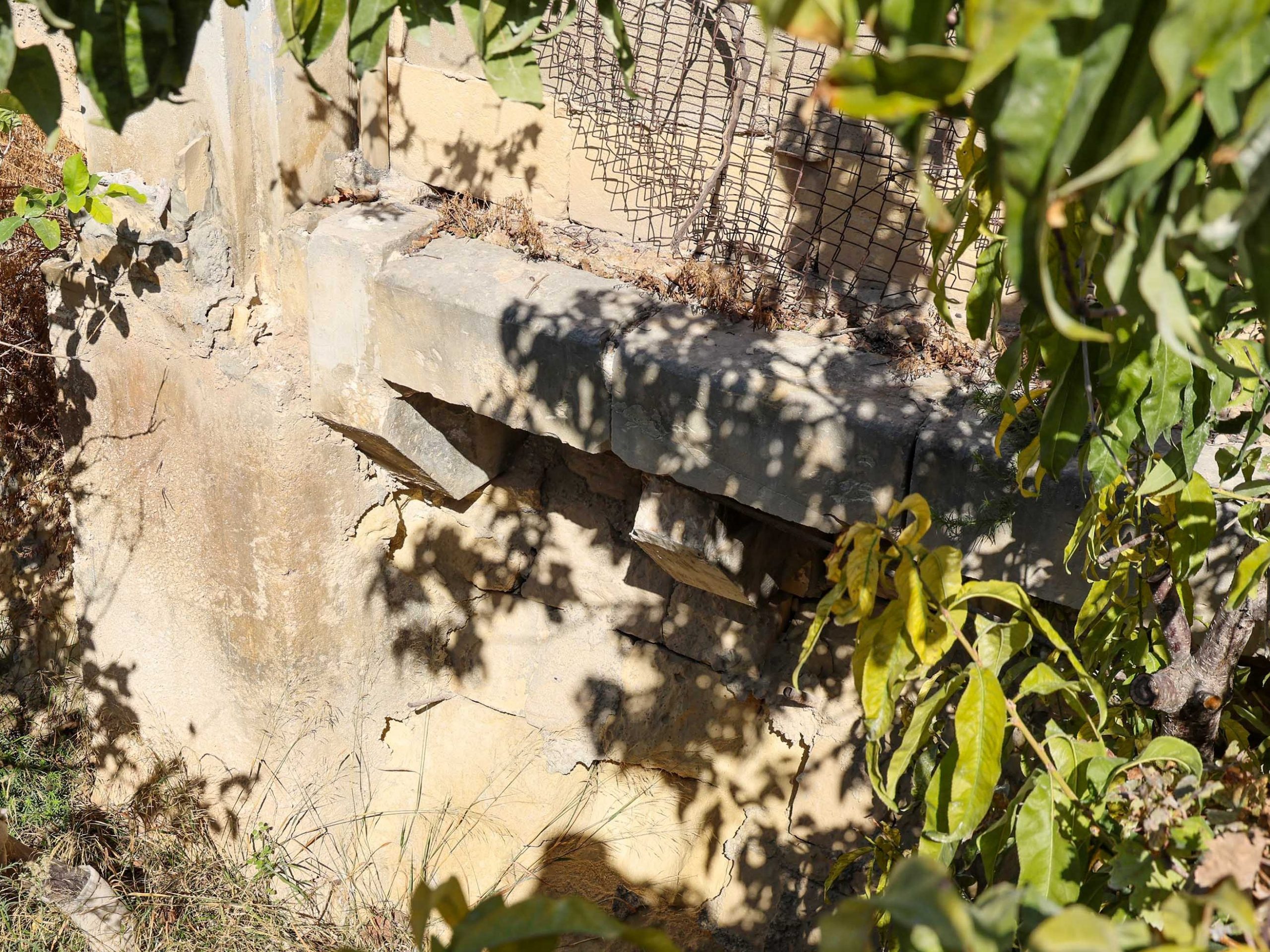
The modern infill to the cutting beyond the bridge is framed by two stone abutments, one on either side of the line. Substantial features, it’s not clear what they were planned to support, but they may have been intended for a footbridge that was never implemented.
Feint traces through to Mile End
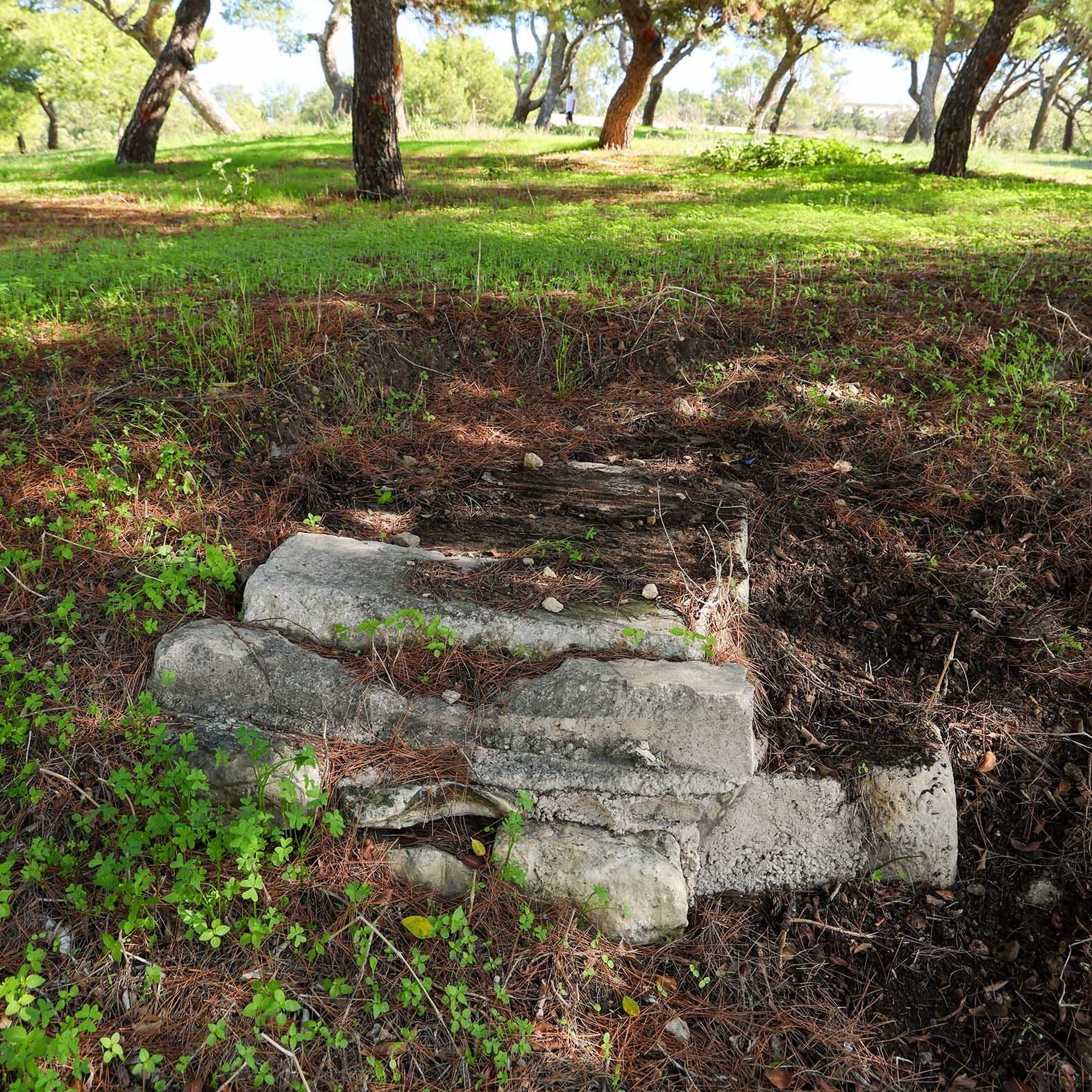
Only feint traces of the railway survive between Floriana and Hamrun. The Princess Melita Avenue road bridge was quickly demolished on closure of the line and Triq il-Indipendenza cuts a broad swathe trough the area today. However, a fragment of Malta stone structure still projects above the turf of George V Jubilee plantation on the east side of the highway, likely to be the remnants of the bridge abutment.
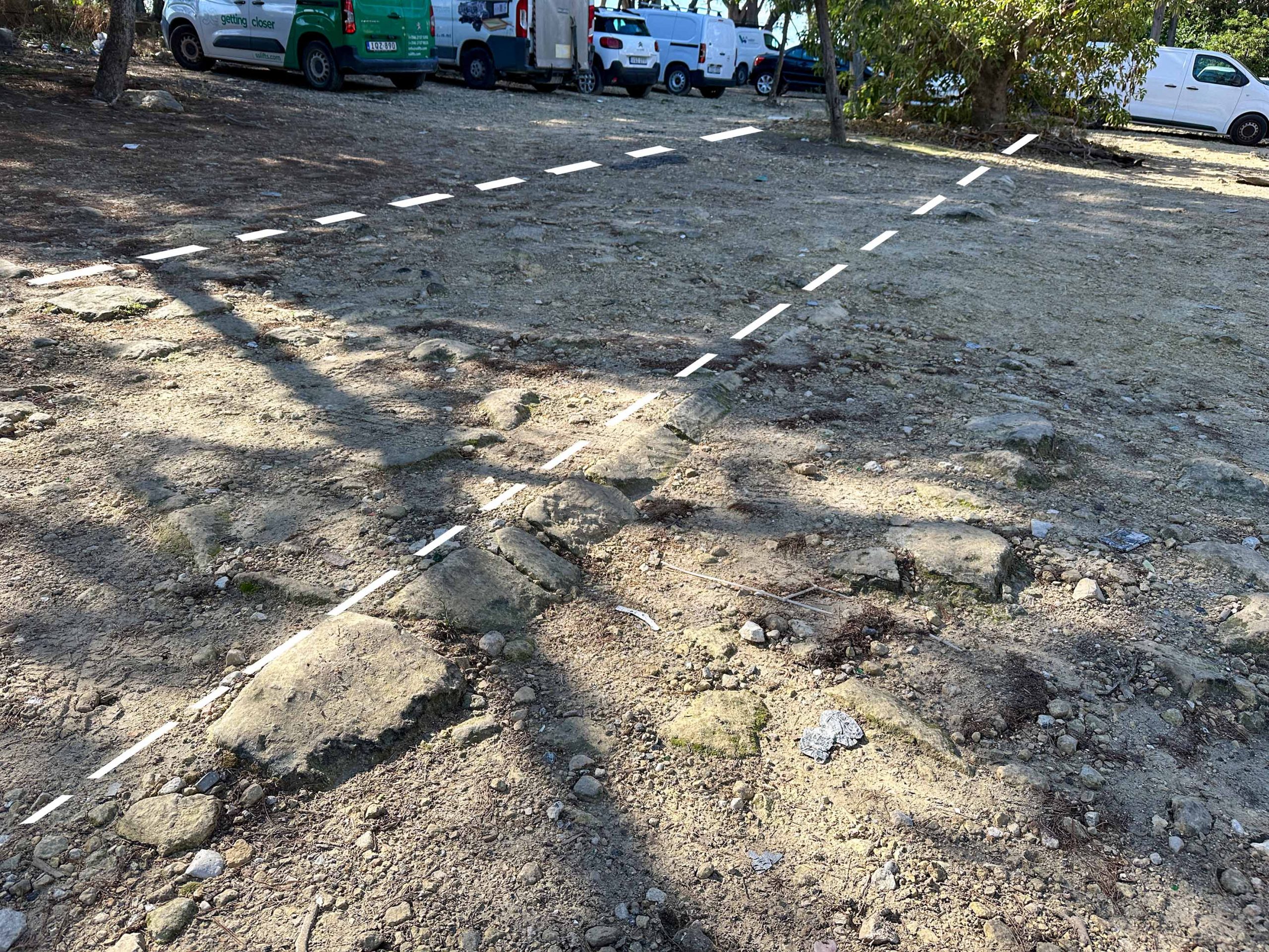
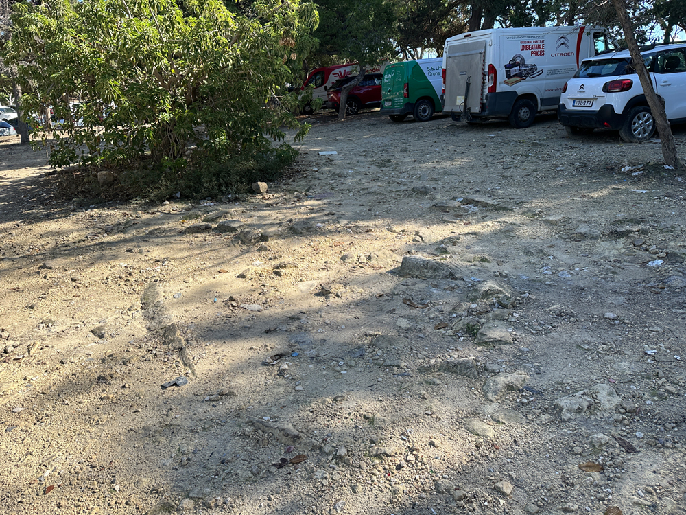
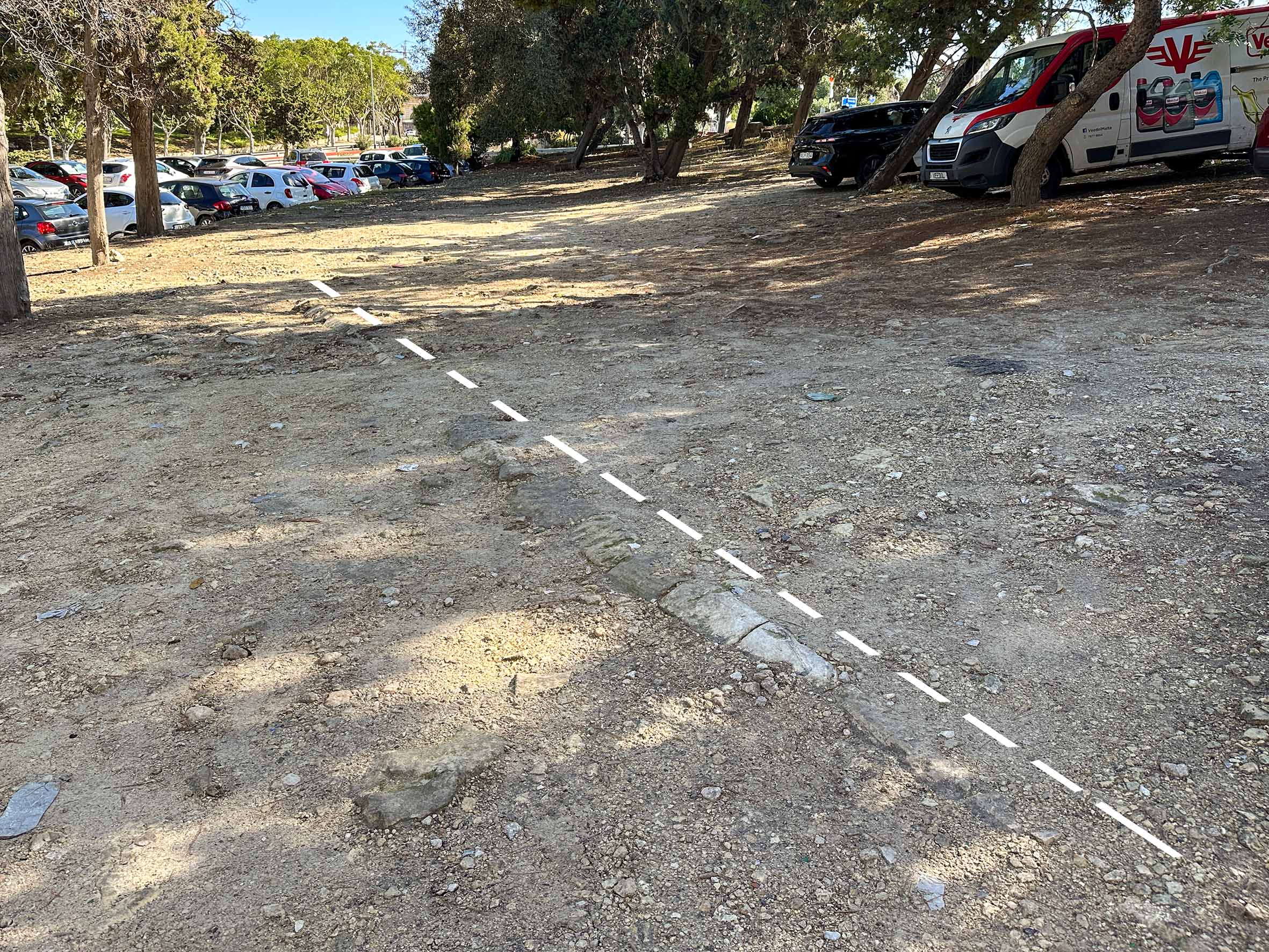
On the other side of a busy traffic junction is a gravel car park. Kicking about in the dust you can still see stones in the ground, set along the former track alignment. These have a distinctive batter or slope to them.
These are the coping stones of the railway embankment on the north side and cutting wall on the south. They can be traced intermittently through the car park and a planting bed before terminating at Ta Braxia road at a raised level. The wall against the side of the road here represents the abutment location for a bridge that once crossed the lane here.
Pavement replaces the railway towards Mile End before the road system near the Spencer Monument and later development obscure all traces. Hidden from view in back gardens behind Mile End Road the curve of the line can be traced in aerial views, but it’s not until the junction with Triq P. Xuereb that the explorer can rejoin the original alignment again.
To the limits of Hamrun
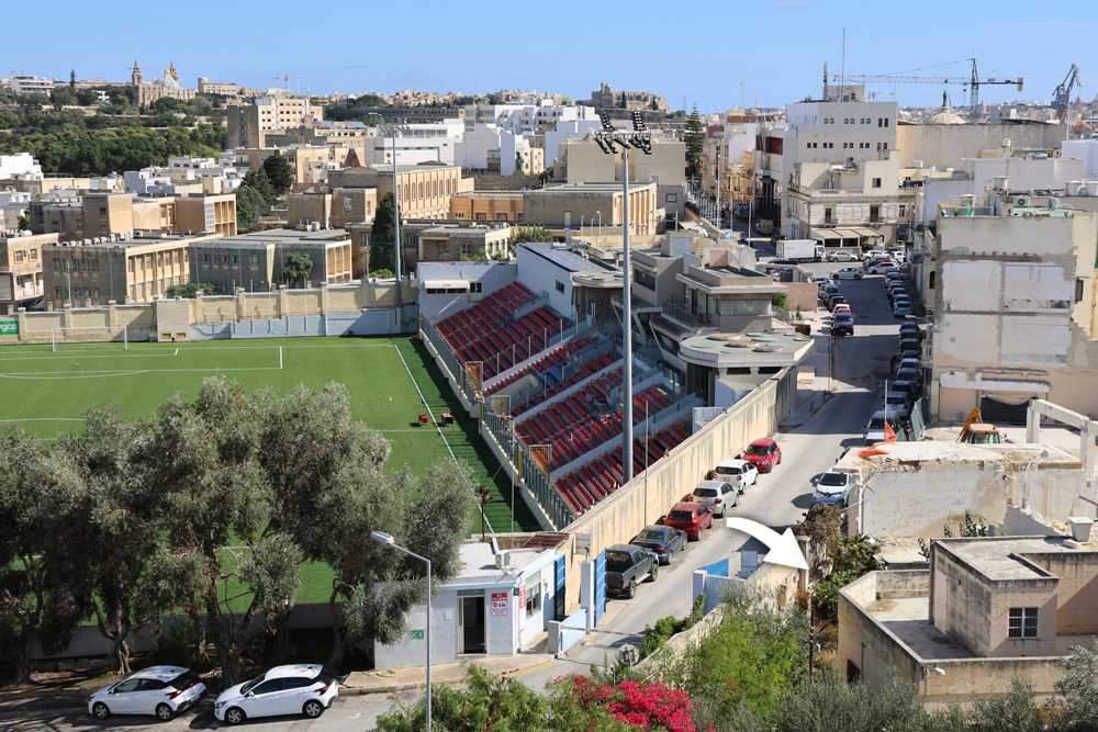
The road makes a gentle curve adjacent to the football ground following the old embankment. Hidden in private gardens is a section of a heavily corbelled face of the stone embankment.
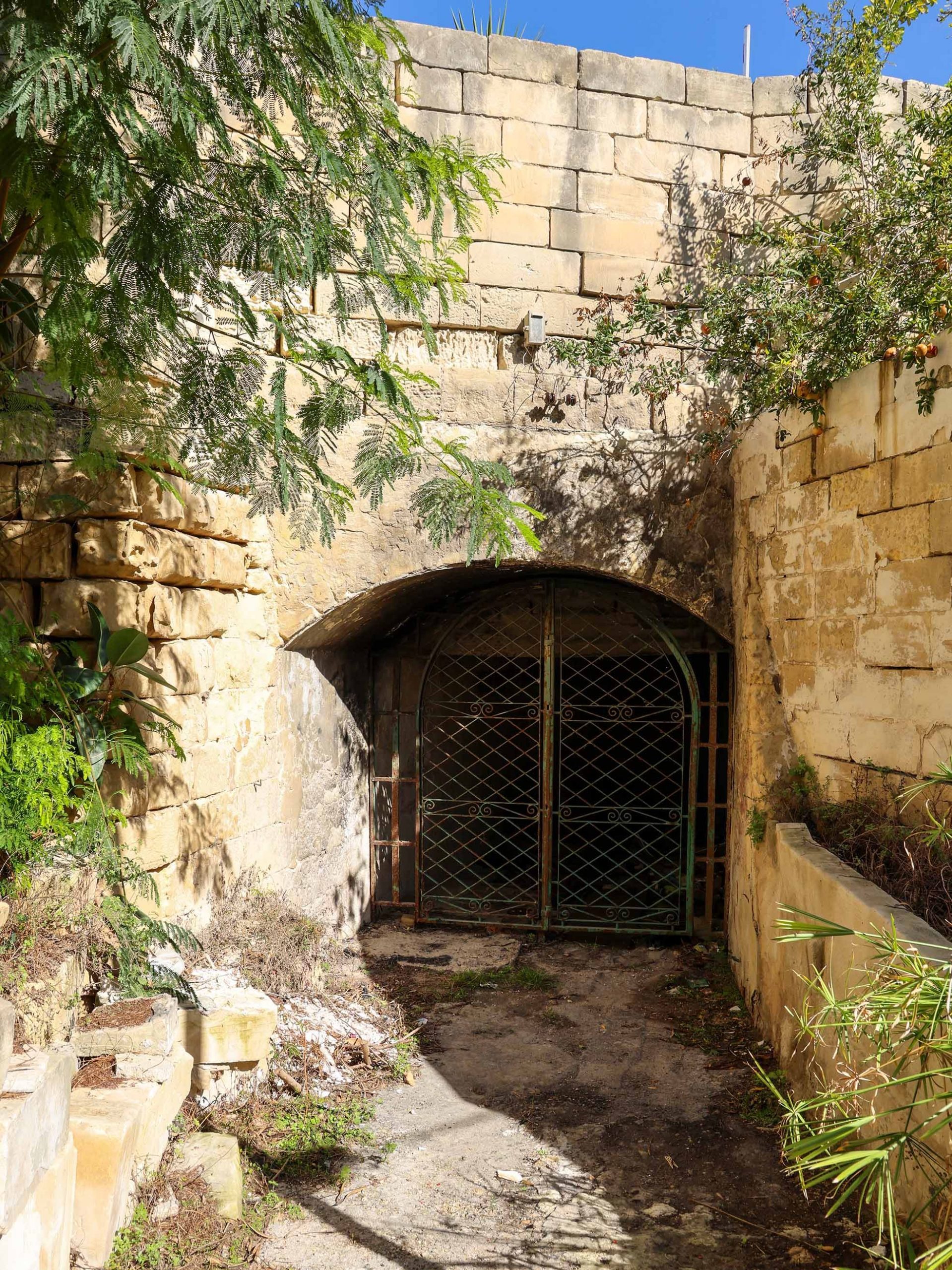
For the particularly intrepid a detour can be made to find one of the historic underpasses designed for a vicolo or lane to cross below the track. The bridge survives in good repair and has to be approached down a winding lane from St Joseph High Street, the main road through Hamrun.
Walkers following the route of the railway will similarly need to detour here. The Benna milk depot that occupies the former railway depot blocks the way through to the station site.
Previous station – Next station
