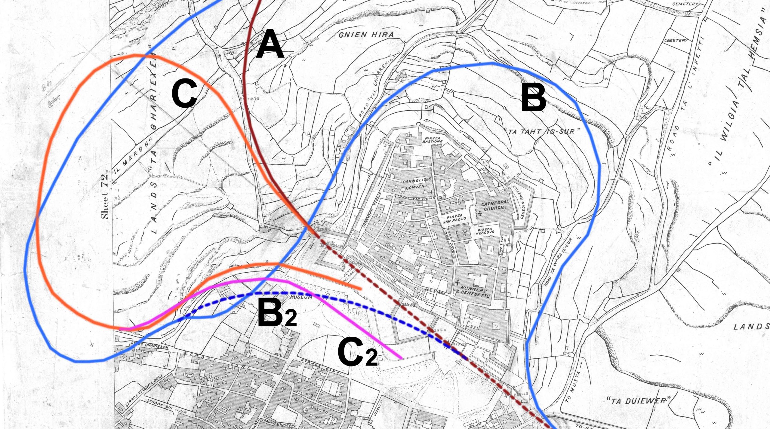
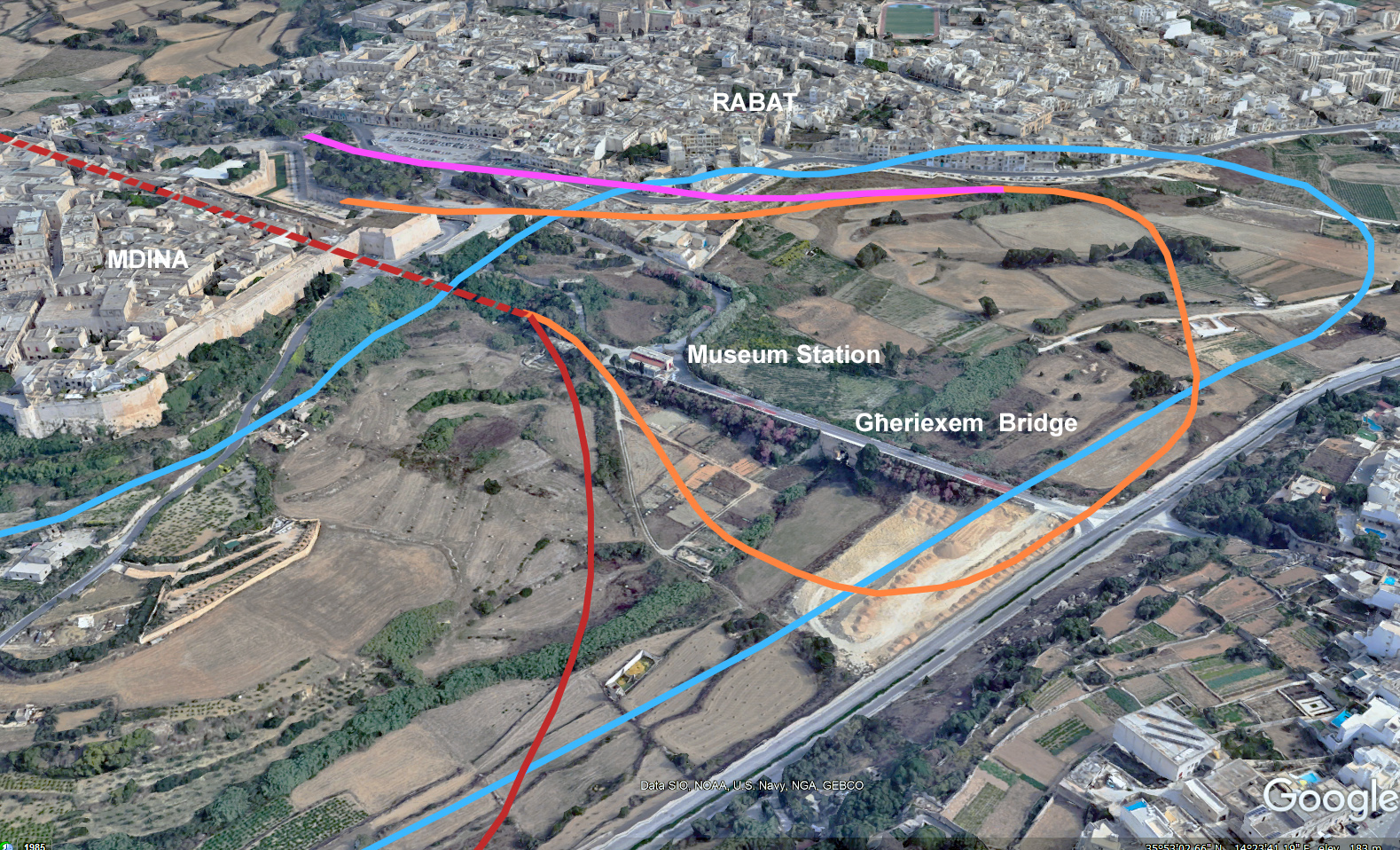
Close inspection of an early plan to tunnel the Malta Railway under Mdina, drawn in around 1894, reveals a spaghetti of crayon lines in red and blue that at first sight look like accidental scuffs or kid’s doodles. However, looking at them more closely they seem to be a series of alternative ideas to try and provide a more convenient station for Rabat and the Silent City.
The drawing shows a definite proposal (marked A on the diagram below), one that closely, but not precisely, follows the final route across the Għeriexem valley. Rather than vaulting directly across the Mtarfa, this would take a lore leisurely curve to continue the line around the plateau and, presumably, on to Marfa.
Route B would require no tunnelling from Notabile station and tracks a level, but long, languorous, and winding course along the landscape contours. This proposal (B), suggests a new station could be built behind the Domus Romana museum before descending in a gradual loop that follows the topography and descends past Mtarfa, probably on another heading towards the west of the island. A feint line suggests that the loop around Mdina’s fortifications could be avoided by a short-cut in a curved tunnel under Rabat.
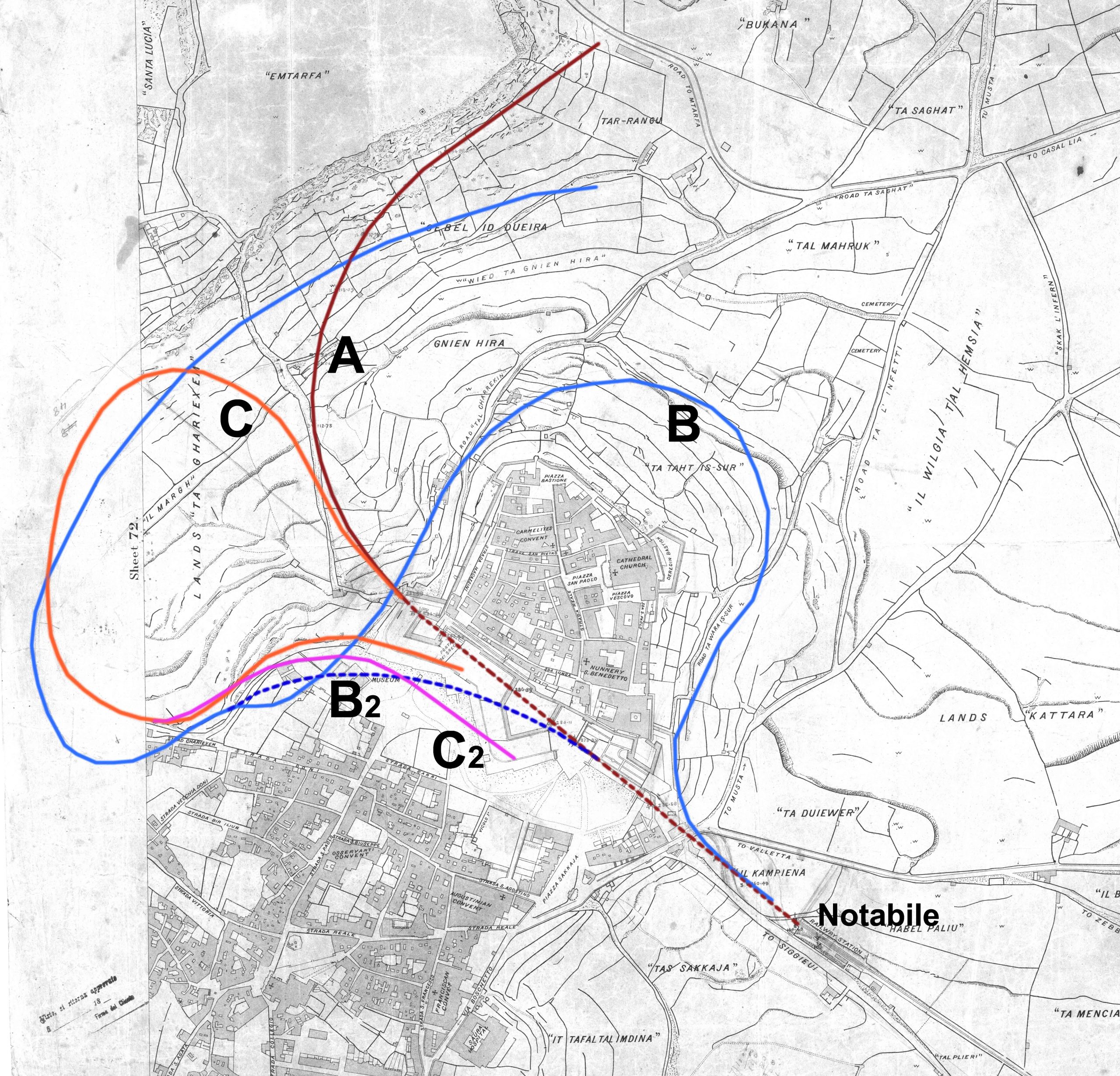
The last of these sketch proposals attempts to address the problem of the significant difference between the level of Notabile station and the higher altitude of the towns above. It branches off route about where the tunnel exited into the Għeriexem valley and takes a corkscrew loop ascending the sides of the valley to bring trains up into the Mdina ditch were, no doubt, a station could be located. A second thought (C2) took a steeper course to extend closer to the city’s main gate with a station in Howard Gardens
Most of these proposals seem crazy for the efforts they went to in bringing the line closer to the towns they served. The routes would add either significant and unnecessary length to the line, or require significant new infrastructure, bridges, embankment, and cuttings, to achieve only moderate benefits. Ultimately, plan A would seem to be the least arduous course, but even this was altered in execution, committing the railway to tunnelling under Mtarfa if the long-anticipated extension to the Gozo ferry was ever going to be achieved.

No responses yet