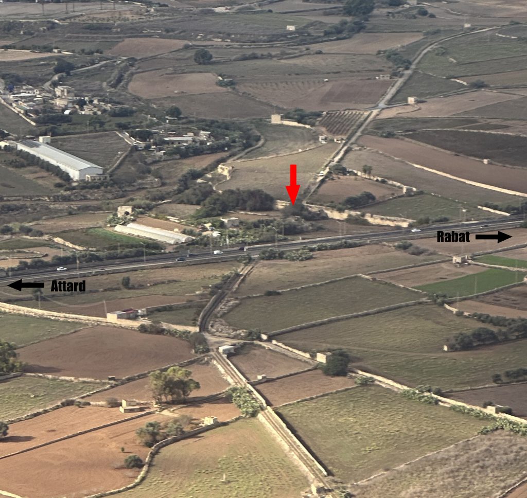
As the Malta Railway entered the rugged rural landscape uphill from San Salvatore its character changed. It became relentlessly steep, picking its way field-by field towards Notabile.
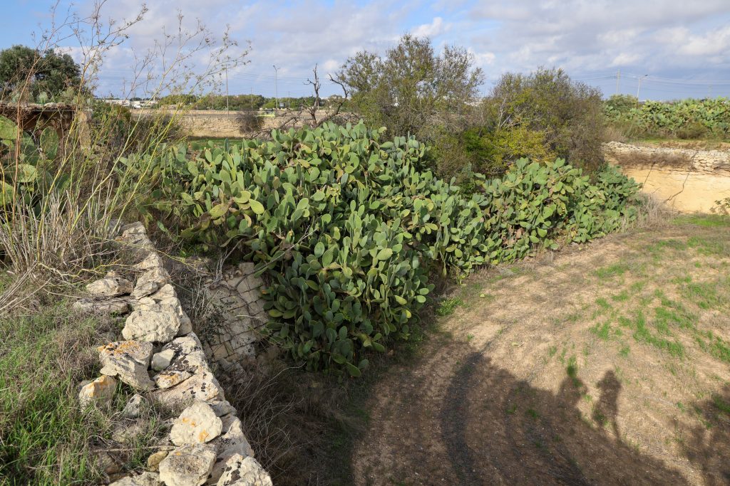
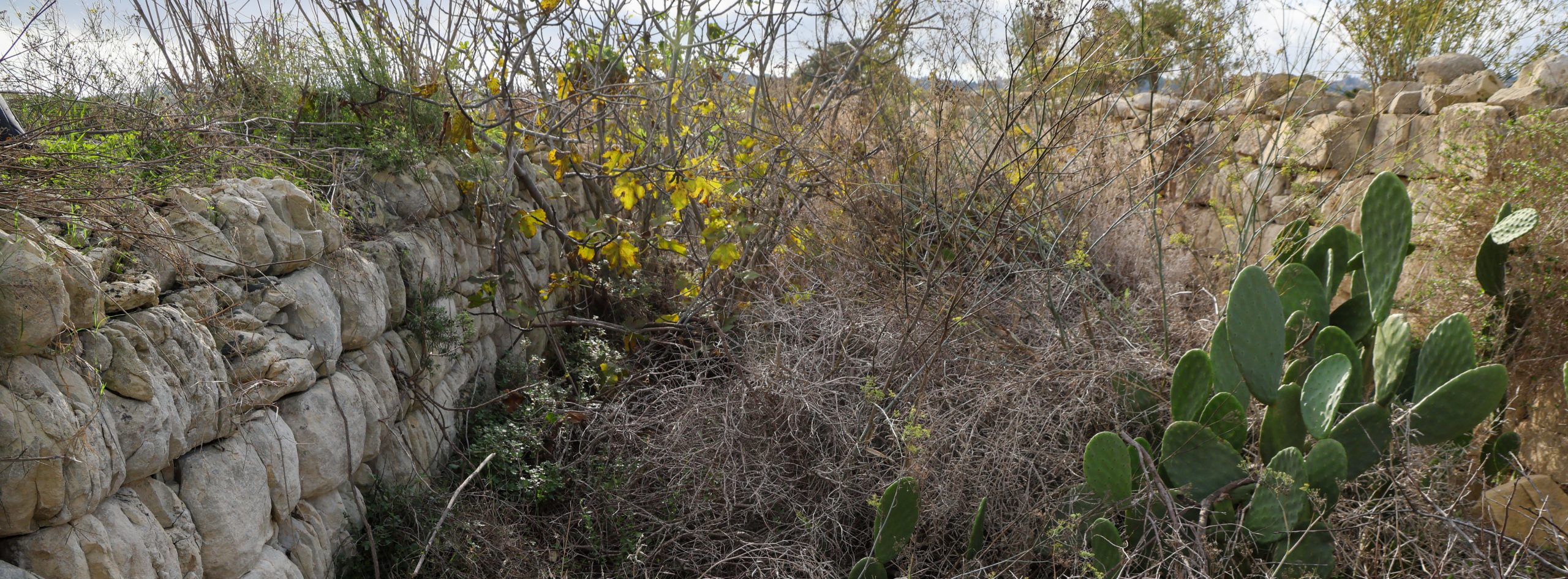
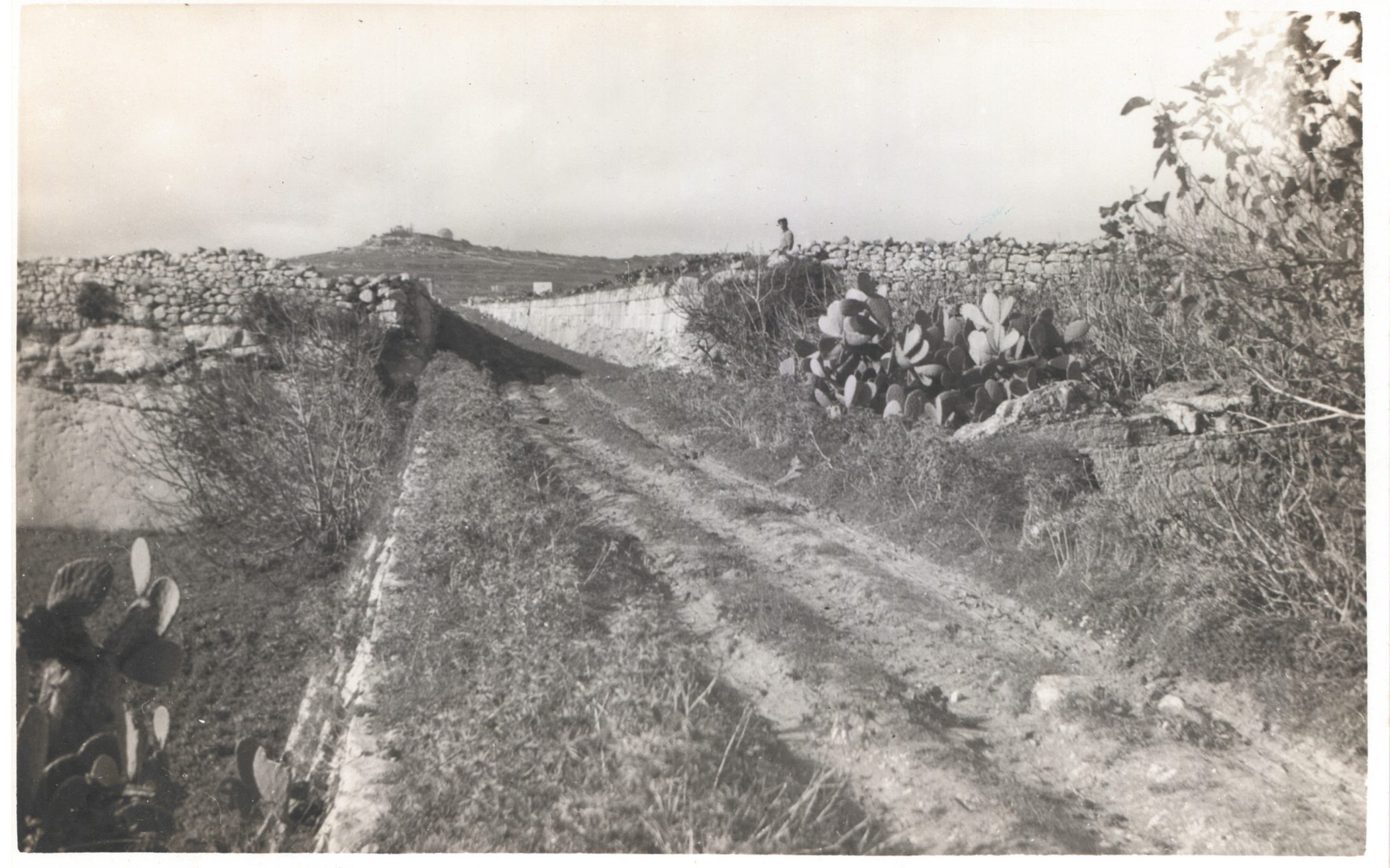
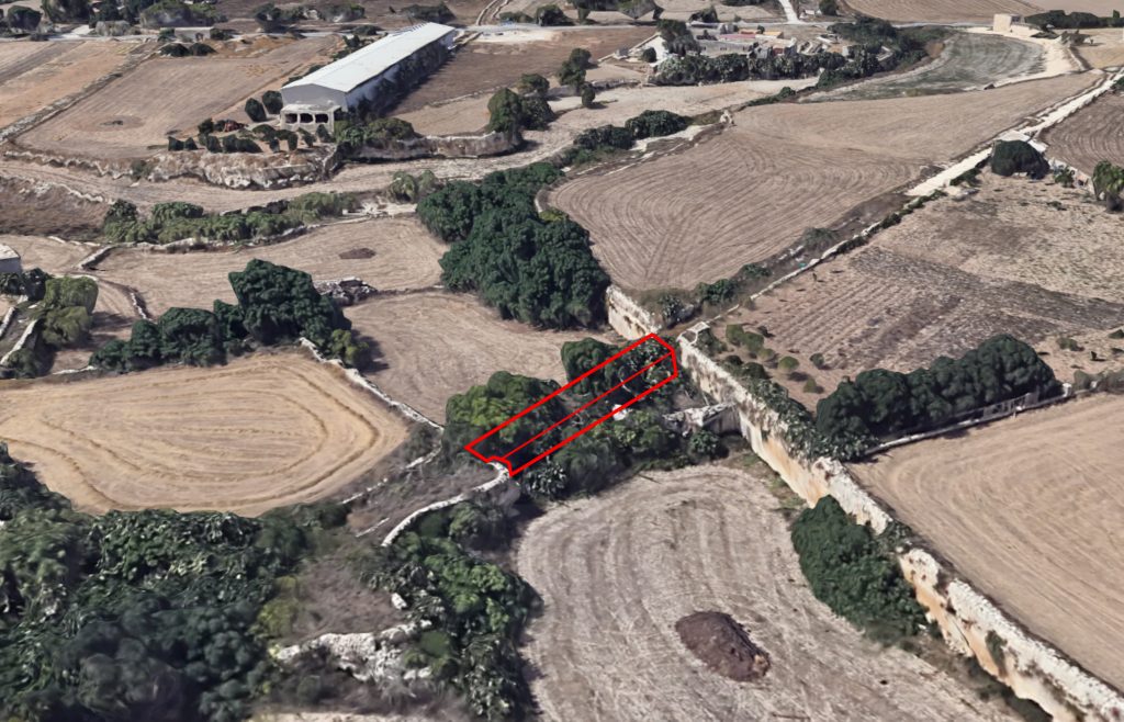
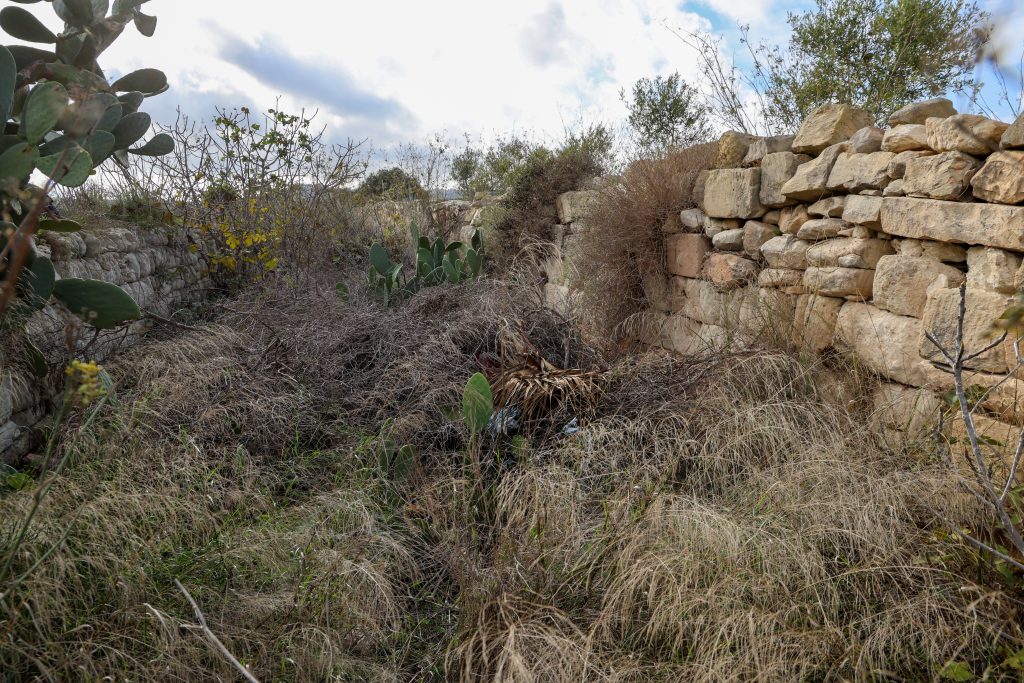
The route had to negotiate other physical challenges like this sudden deep gully, just beyond the Mdina Road and 5.5 miles out from Valletta. Although hidden today by vegetation, the tall stone-built embankment approached on either side by sheer cuttings can still be made out.
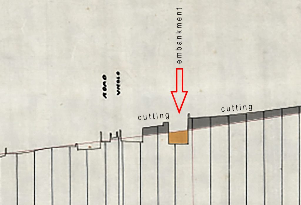
It’s difficult to work out whether it incorporated a bridge, but it must have added a little drama to the journey. Passengers at first first dropped beneath the level of the surrounding fields before launching over the high causeway and then back into the confines of another cutting.
It was one of the locations chosen to photograph when someone took to recording lost railway features in the early 1940s. The black and white image is clearly taken from the top of the embankment looking in the direction of Notabile. Unfortunately, the agricultural track has been long abandoned and shrubs obscure any appreciation of the hidden engineering work today.

No responses yet