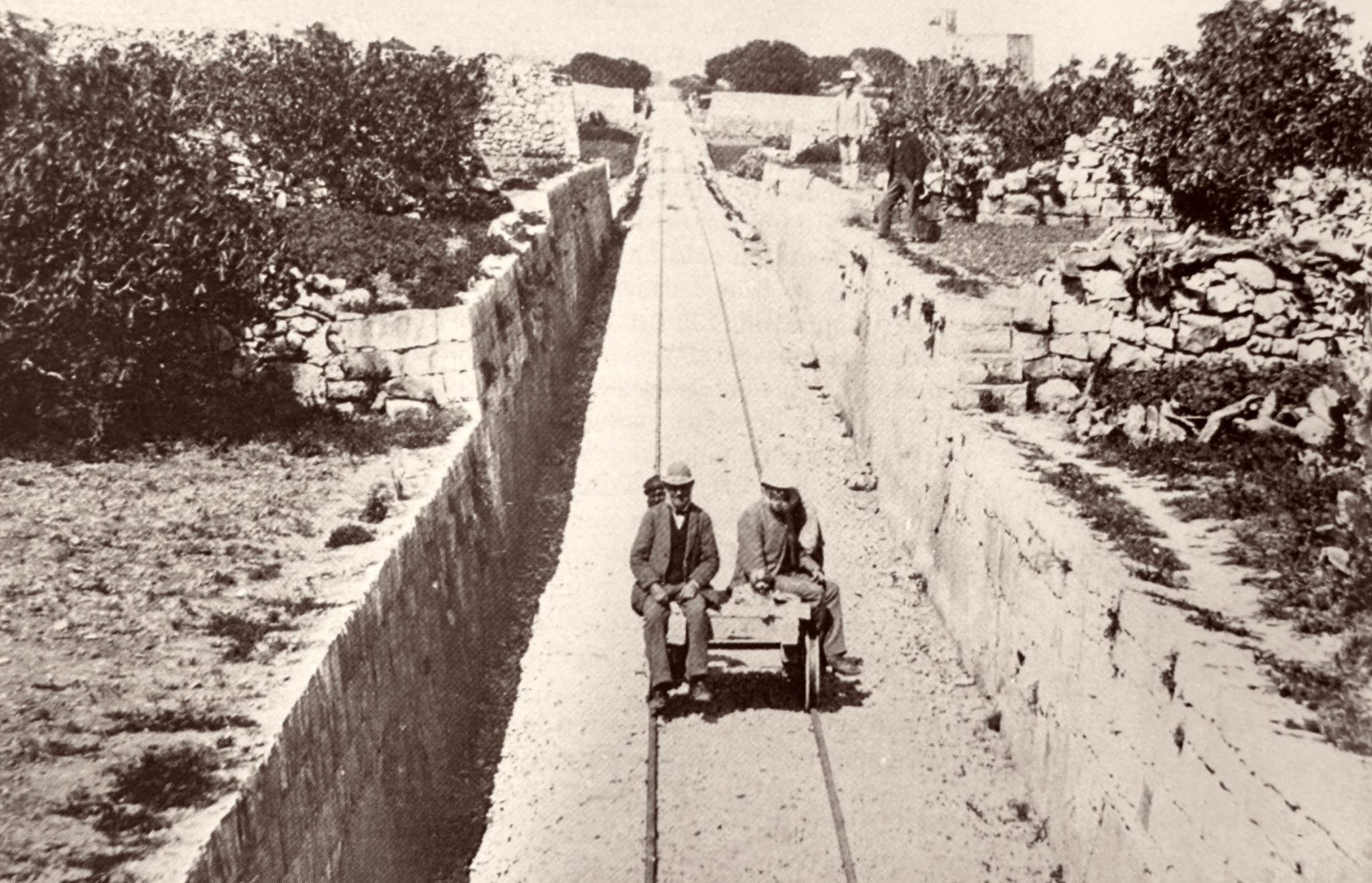
The historic photo above showing the nearly complete Malta Railway has long been stated as being the cutting west of Attard, but this identification now needs correction!
I was fortunate enough to see copies of a number of the original images from April 1882, commissioned to show investors progress on the line was well advanced. A number are now part of the collections of the National Museum of Archaeology library in Valletta and being able to see them in new detail has uncovered new revelations.
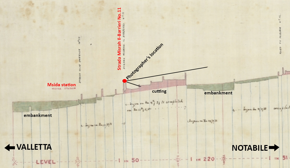
The original caption on this photo, cropped off in the published versions of the view, describes the location from which it was taken as being taken from “Strada Misrah Il-Barrieri” rather than Attard. This road crossed the railway close to Msida station. The line of the railway here is now Triq Il-Kappillan Mifsud.
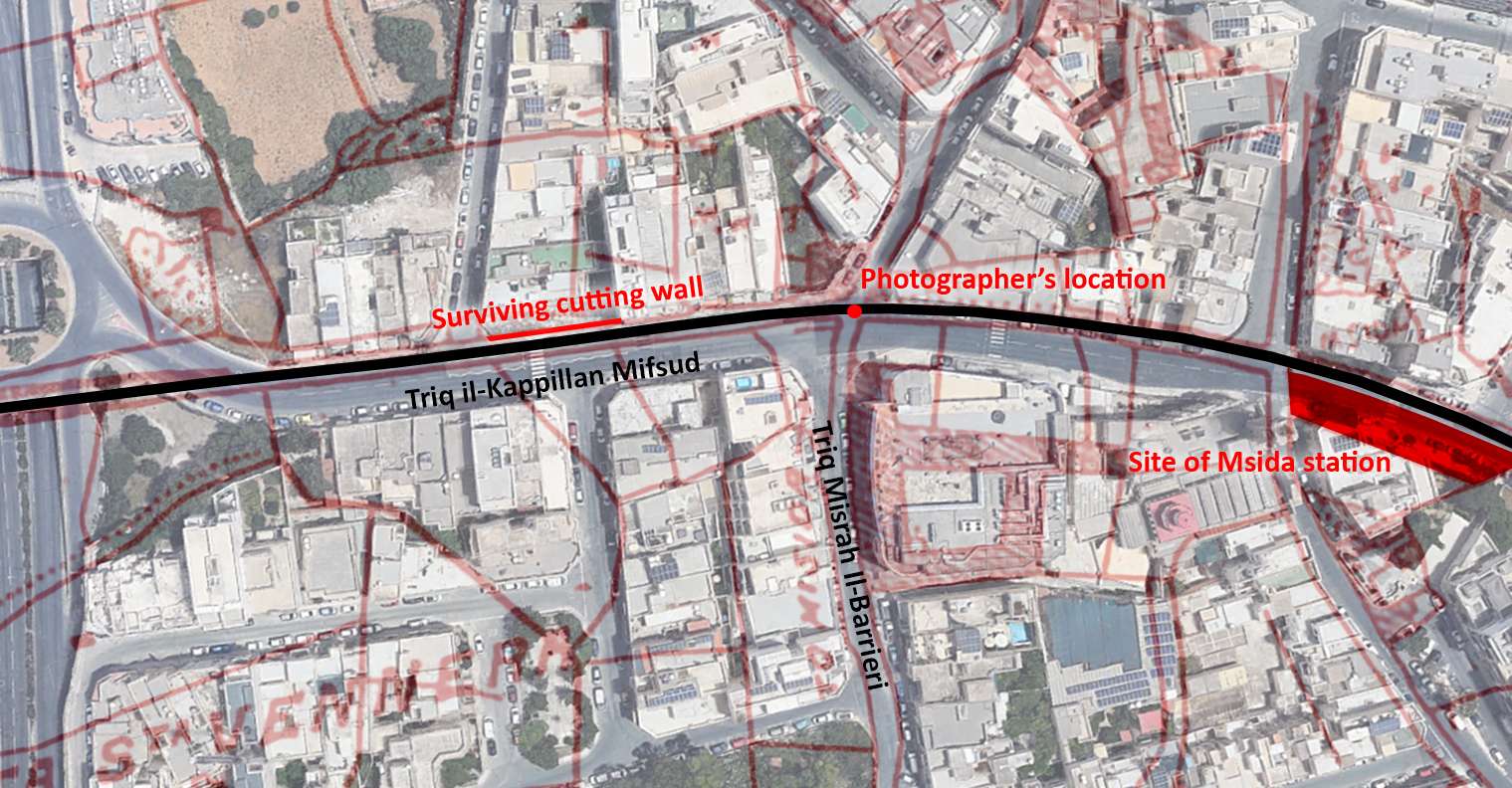
I’ve not reproduced the original here, for copyright reasons, but the version published by Bonnicci and Cassar in their book, and where the location is erroneously described as Attard. I have included some better quality excerpts of the photo in the attached diagram with details of some features which can still be picked out today.

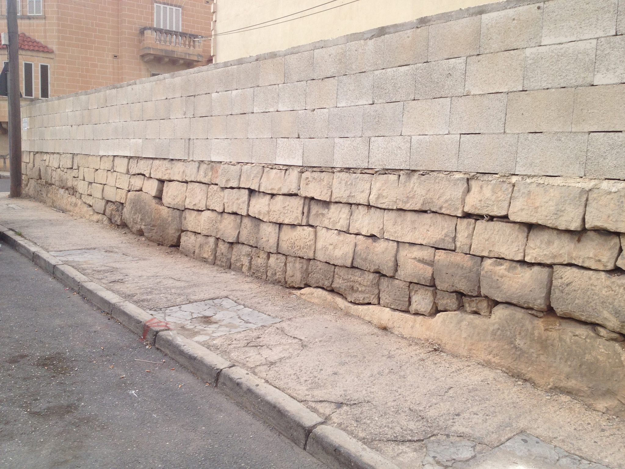
Indeed, the landmarks in the background correspond with some still standing today in the Santa Venera vicinity. Fascinatingly, a section of the original cutting wall clings-on along the north side of the road here, and can tentatively be identified in the original photo.
The importance of this rather overlooked but substantially built section of wall in Santa Venera is known by Malta Railway enthusiasts, but really deserves wider recognition as an identifiable survivor of the railway. Hopefully, with its memorialisation in an original photo, it might reach a new audience.

No responses yet